


Search Results for Tag: sealevel rise
Exploring the North – Looking South: On a bottle of wine and into the ocean
But the Arctic isn’t the only place that’s important for the planet. Just on the other side of the planet, there’s another precious region: Antarctica. Why? Antarctic glaciologist Kenichi Matusuoka from the Norwegian Polar Institute explains this with the help of a bottle of wine.
Imagine holding a bottle of wine. The wine inside the bottle is very precious (and expensive), compared to the rest of the bottle – the glass body and the bottle cork. The wine corresponds to the ice in Antarctica: It is important for the planet as its melting could lead to a rise of 45 meters in sea levels.
Now imagine you turn the bottle upside down – the previously unimportant cork now becomes quite important as otherwise the precious wine would pour out. You can well imagine that the cork is now crucial, whether or not it’s a crumbly old cork that is only plugged loosely in the bottle neck, if you want to find out whether the wine will pour out or not.
That is why scientists focus on investigating the properties and melting behaviour of ice shelves, which is what the cork corresponds to. To be correct: Antarctica does not only have one “cork” like a bottle has, but several – those on top behave differently. But the overall research question is, whether climate change weakens the corks/iceshelves so intensely that they cannot withstand the pressure of the wine/Antarctic ice and finally might let it pass.

Antarctica from space: Blue-pinkish coloured are the ice shelf regions, where ice flows quicker than on land-grounded ice (Photo credit: NASA/JPL-Caltech/UCI)
During my travels in the Arctic region, I actually met a researcher who worked on the dynamics of Antarctica’s ice shelves. Tore Hattermann investigated the melting of a certain ice shelf underside. To get back to the cork analogy, you can imagine that it is rather crucial what size the cork has. If it’s too slim, the wine behind can easily push it away.
In West Antarctica, for example, a change in ocean circulation leads to warmer water below the ice shelves that starts to melt, contributing to more than two thirds of Antarctica’s mass loss. Now, computer simulations predicting that those circulations also transport warm water below the Fimbul ice shelf suggest additional melting. The Fimbul ice shelf is located not in the West, but in the East and has similar geographic conditions as the melting Western shelves have.

Tore Hattermann working on Antarctic ground – attentively observed by a penguin (Photo: Johan Hustadnes)
So, together with other scientists, Tore went on an Antarctica expedition to see whether the simulations are correct and if they could really find warmer water underneath the Fimbul ice shelf. Using boiling water, they drilled holes through 400 meters of ice and passed oceanographic instruments into the ocean below. Over two years those instruments measured water properties: its flow velocity, temperature, salinity and oxygen content. After analyzing the data collection, Tore could prove that the computer simulation was wrong: There was not that much warm water circulating under the Fimbul ice shelf, therefore it wasn’t melting at the extent predicted.
For most people this might seem a disappointment, but for scientists this is rather routine: proving models (wrong). In order to improve or adjust the models in the next step, therefore they depict reality better and predict Antarctic ice shelf melting correctly.

I did not want to deny you this drawing, as sometimes pictures say more than words. That’s this issue explained in a(n abstract) picture. Savvy?
Watch out for the next issue to find out, what the expedition to Antarctica was like for Tore.


![]()
Sealevel rises quicker than expected
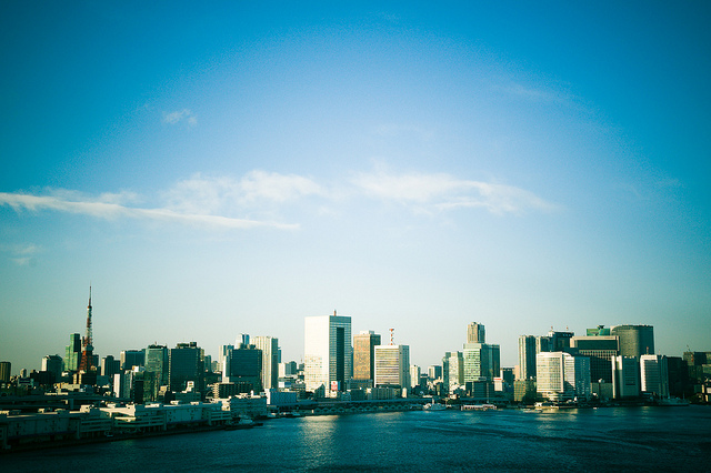
Many coastal cities, as for example Tokyo, will have to find a way to cope with rising sealevels (CC BY 2.0: oisa/flickr.com)
At the Doha climate change conference, delegates of the COP18 again try to find a practical way how to (further) reduce greenhouse gas emissions. The importance of this goal was again highlighted by a new study released recently by the Potsdam Institute of Climate Impact Research (PIK): Researchers found out that sealevel rose much quicker than projected by the latest IPCC report.
That’s what they saw when comparing the model calculation with real satellite data from 1990 to 2011. According to those satellite measurements, oceans are rising 60 percent faster than previously thought. In absolute numbers: the IPCC report from 2007 projected additional 2 mm sealevel per year, satellite data revealt a rate of 3.2 mm per year.
Which might seem less in numbers, can make a huge difference in reality. Already for the projected 2 mm, researchers warned this might lead to flood waters, more extreme storms, and salted ground water. Yet, nobody can forecast what exactly is to happen with a higher rate of sealevel rise. But nonetheless, threat for coastlines and megacities continues to increase. Especially if no reliable mechanism will be found to reduce CO2 emissions – as in consequence sealevels will rise by several meters at the end of this century.
![]()
An island running dry

Photo: S. Ferse, ZMT
Climate change is looming large in the island state of Indonesia, where rising sea levels pose a major risk. But it’s actually a different problem that might force inhabitants of the Spermonde archipelago lying off Southern Sulawesi to leave their islands: drinking water is running low, and the existing water quality is getting worse.
A team of German and Indonesian scientists is pointing to climate change as a major source of that problem. Many of the islands get their drinking water from a freshwater lens – a layer of drained rainwater that accumulates in the soil. Just one lens is about ten to twenty centimeters deep and covers a large part of the archipelago.
Because of climate change, the island region is expected to be face more and more extreme weather patterns, from droughts to severe rain. But the torrents of water that hit the earth during monsoon seasons don’t have enough time to seep into the soil. Instead, the lion’s share flows over the earth’s surface and into the ocean. And the growing amount of sealed surfaces make matters worse: because the area is densely populated, a lot of ground is covered by streets and buildings. Plus, heavy storms – expected to become more frequent – are washing seawater onto the islands and into wells.
Still, climate change is just partly to blame for the dwindling water resources. Since the beginning of 20th century, not only the number of inhabitants but also the demand for drinking water has doubled. As there are no rules preventing anyone from digging wells anywhere and no official limit on how much water may be drawn from them, many locals have dug wells themselves. But they have little knowledge of the soil’s properties or the freshwater lenses when pumping. And when salty water from deep below mixes with the fresh water near the surface, it becomes increasingly brackish – bad for people and the environment.
![]()
Feedback