Changing Climate, Changing World


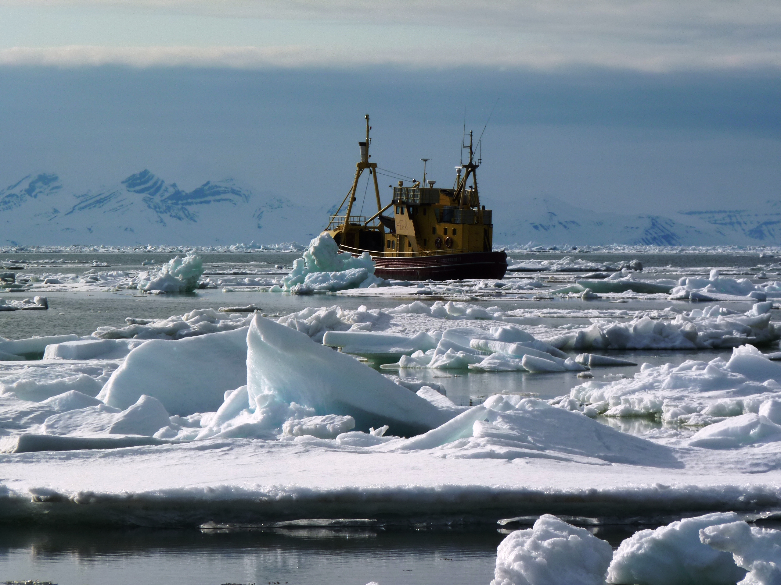
Changing shades of ice at 2am
I just read an advertisement for “mobile tourist cabins”. The main advantage listed is that you can move them around to cope with climate change, so that you can shift them with the ice sheet as it retreats.
Climate change is very obvious here, although I’ve met a few people who still think it could be just natural fluctuation. Some of them are people in the tourist industry. Jens Laursen, the manager of tourism in Kangerlussuaq is unwilling to accept a connection between emissions from air travel and retreating ice. He is, of course, dependent on people coming to Greenland by air. Flying is the main way to get anywhere here, and the distances are huge on the world’s biggest island. In winter, dogsled has traditionally been the main means of transport, not only for personal use, but for instance for fishermen, who bring large quantities of halibut they catch by a long line dropped through holes in the ice over the snowy slopes to Ilulissat. But this is losing importance, as the season when there’s enough hard-packed snow for it to be viable is becoming shorter, and the winters become less predictable.

Accounts from the locals here back up what the scientists are telling us. Morten Rasch, the man behind the Zackenberg ecological monitoring programme, for example, stresses that the variability of the climate will increase. Yesterday I interviewed Karen Filskov, who comes from Ilulissat and now works for Destination Avannaa -the regional office promoting development in the huge region of North Greenland, Qaasuitsup kommunia. It’s said to be the biggest municipality in the world in terms of area, with 660,000 km2. She told me a series of winters in a row up to 2006 had been so mild the fishermen could fish from boats in the bay rather than taking the dogsleds to the ice. A lot of them then got rid of their dog teams, which are expensive to feed. Then the last two winters were particularly harsh. The water was frozen, and they had no dogs. It’s becoming increasingly changeable, she says.
Karen told me there are still 3,000 dogs in Ilulissat. Most of them now have to be kept outside the town centre – admittedly not far away. There’s a weird rugged rocky area dotted with little dog kennels and huskies – chained so they don’t run around fighting in packs – dozing in the heat beside their sleds.

The captain of the “Pearl”, a boat that takes people to see calving glaciers up the coast, told me he had not only noticed differences in his work on the water. He used to travel around, for instance to matches with his local football team, using the dogsled in winter. Now, he says, he can only rely on that for a few weeks rather than a few months. Incidentally, I talked to him with the assistance of Laali Berthelsen from Nuuk, the capital of Greenland.

She’s working here as a guide in between her studies. She’s one of the few people here who seems to have recognised the potential of learning languages and the tourism industry. Most of the people working as guides here are from Denmark or other European countries. It seems there’s still a lack of locals with the necessary language skills. Nowadays, the children (and there are plenty of them here) are learning English at an early stage in school, so perhaps the next generation will be different.
Laali also told me she used to get new skis every Christmas as a child in Nuuk. These days she has to go somewhere else if she want’s enough snow to ski.

Ilulissat’s glacier, Sermeq Kujalleq (Jakobshauen) and the ice fjord (Kangia) are striking witnesses to the process of global change (assuming you know what they were like before, that is).

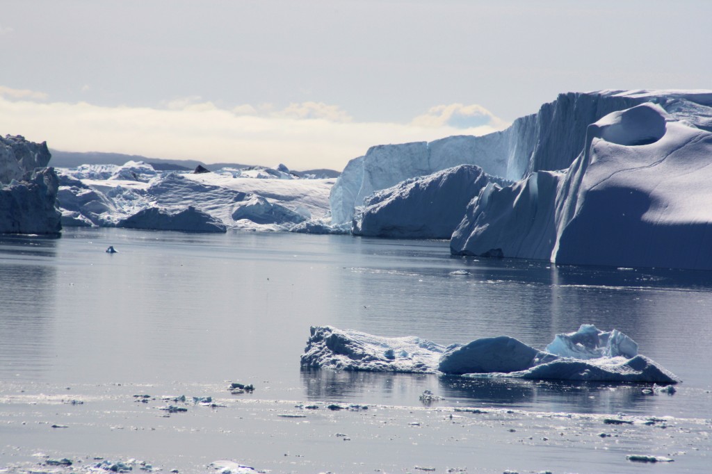
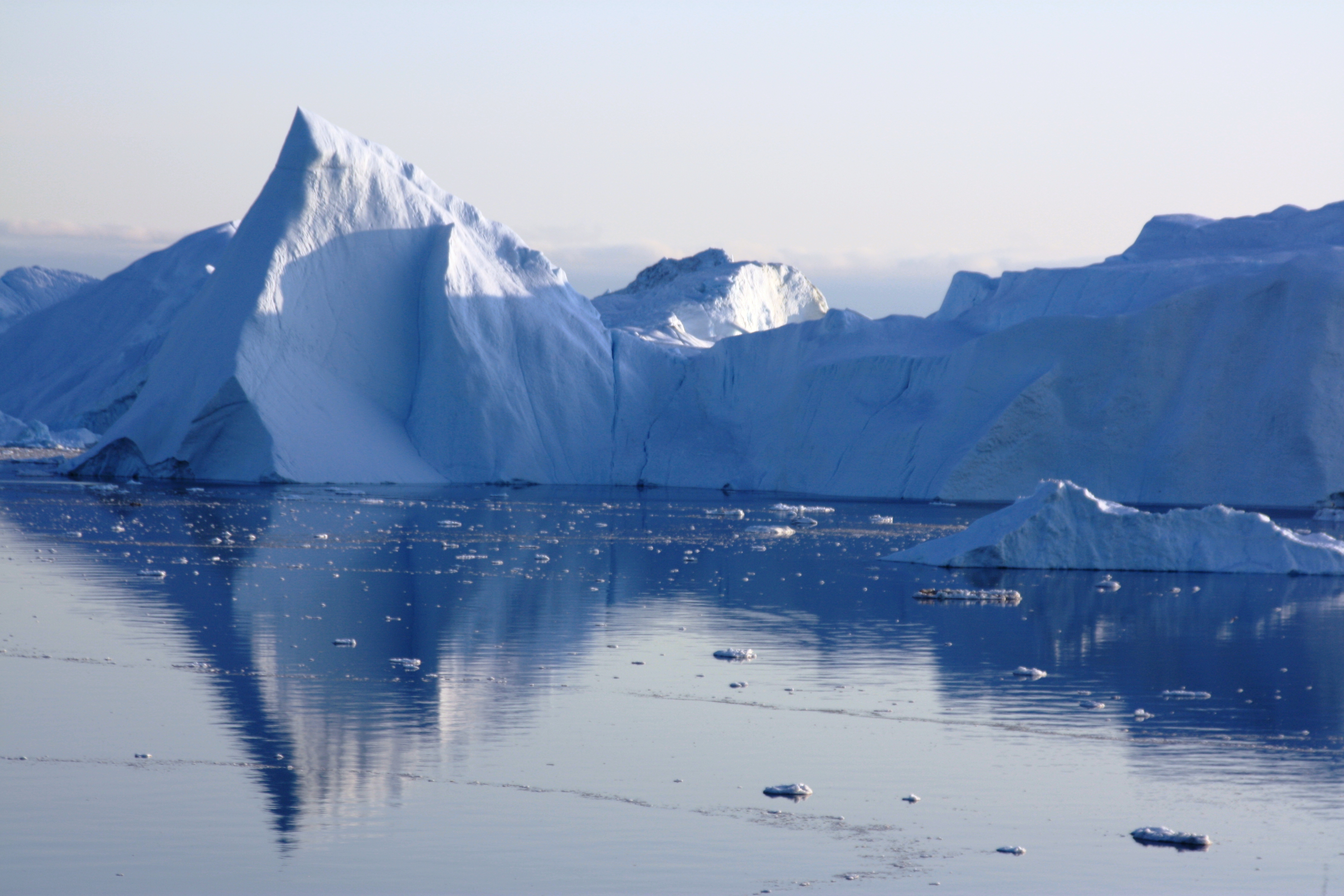
The glacier discharges ice from the inland ice sheet into the sea. The pieces that break off are stranded in the fjord, where the water is fairly shallow, resulting in the spectacular jam of icebergs, some smooth, some jagged, over kilometres, right down to the mouth at Ilulissat. But the glacier itself has retreated massively, especially since 2001. Karen tells me the icebergs are smaller (although still huge), because the ice is also thinner.

“Global Contact” in the Town on the Icefjord

Ilulissat was once a small trading post. Nowadays it has 4,500 inhabitants, and the number is growing rapidly.

You can smell fish in quite a few parts of the town. Fishing is the number one industry

It happens on a commercial scale, particularly for halibut and shrimps. The town has a shrimp processing factory. The fish factory has moved further south, and people tell us the trend is increasingly towards factory ships, which process the fish as they’re caught.
Administration is the 2nd biggest employer. Ilulissat is the centre for a huge area around it, going right up to Quanaag in the far north. Tourism is the 3rd factor. It’s growing, but currently suffering from the world economic crisis. There are actually very few tourists in the town right now. The town still feels like boom-town, and the civil engineer tells me all the building work is the rush to build new houses for the growing population in the very short building season, before everything has to stop for the winter in October.

Ilulissat’s main attraction are the icebergs, floating in the fjord after breaking off from the Kangia glacier or Jakobshauen, which was the Danish name for it and the town. This is the most “productive” glacier in the northern hemisphere, discharging ice from the inland ice sheet into the sea at a tremendous rate. More about that later. The constantly changing panorama of icebergs of all different shapes and sizes creates the very special identity of Ilulissat.
The icefjord was added to UNESCO’S World Heritage List in 2004 because of its dramatic beauty and its unique glaciological characteristics. The organisation has now opened an office in the town that keeps an eye on it and supports measures to protect it – with a little help from friends like the volunteers brought here by a group called MS.

Lars from Germany and Martin from Switzerland are two of a group of 10 young people spending their summer holidays as volunteers here. They’ve helped organise a traditional music festival in one of the remote northern towns. Now they’re helping Naja Habermann, who runs the UNESCO office, to mark the hiking paths – like the one that took me along the ice fjord yesterday – which help people appreciate the natural beauty of the region without having too much of an impact on the countryside. These are the people who spend the day walking the paths and painting the markers. More power to you folks!
Mellemfolkeligt Samvirke, “ms act!onaid denmark” is the ngo that brings them here, with its “global contact” programme. They come from a variety of European countries. When I asked them why they do it, Lars and Martin both told me they want to do something more meaningful than lie on a beach all summer, and they’re keen to get to know other peoples and cultures. They also see it as a unique opportunity to get to a remote region of the world they would otherwise fail to see. I asked them whether climate change was important to them, against the background of this glacier discharging icebergs at an increasing rate. While they both said this hadn’t been their reason for coming here, they are very concerned about what’s happening and feel strongly the industrialised west should reduce emissions and its footprint. Talking to young people in Greenland, they found it interesting to hear a different view here. Awareness of the problems is not so high – and some of the people they talked to were happy about being able to grow more food in southern Greenland.

Caroline (right) and Sisse are coordinating the project, both here on a voluntary basis. They’re committed to promoting intercultural dialogue and bringing young people from different backgrounds together to work on projects like protecting the world’s heritage.

“It’s a dog’s life” in Ilulissat. Sled dogs have enforced holidays at least until October.
Ilulissat: the best things in life are free

I have now arrived in Ilulissat, which means icebergs in the Greenlandic language. It’s not hard to see why, or why it’s UNESCO World Heritage. The beauty and uniqueness of the icebergs floating around so close made up for some initial problems with the operators who take lots of money to transport people to view the marvels of the site. Fortunately I chanced upon a wooden walkway leading on to a rough trail marked here and there with cairns and yellow dots, which leads over the rocks to the icefjord. I can’t think of a better way to spend an evening than watching the icebergs shift slowly and change colour in the light of the midnight sun.


On the Greenland Ice Sheet

I have been walking on the world’s 2nd largest ice sheet. It would take 30 days to cross it on foot and skis, and it’s almost 3 kilometres thick at its thickest point. It’s hard to imagine that much ice. And to imagine what it would mean for the world’s oceans if it melted. A disastrous 7m rise is the most common estimate, and views on whether or when that might happen vary widely. It’s a complex process, with a lot of uncertainty. But the Greenland ice cap is undoubtedly losing mass overall. And the IPCC predictions have been well overtaken by the current rate of global change.
I drove to the inland ice from Kangerlussaq in a four-wheel drive vehicle. The road was actually financed by the German car company Volkswagen. They decided around 1999 to build a test area for their vehicles on the ice, and this was the access road. (Seems surprising to get permission to build a car test track across the ice sheet in the national park, but there you are).VW stopped in 2005, so did maintenance it seems. Still, with that and the old US base, people have been telling me this area has the most roads in Greenland.
It’s a gravel and sandy track, but 2 hours take you out to the ice and there are spectacular views on the way.(Also muskox and reindeer, but that’s not our subject today).

This is a view on the approach.
It’s strange – the sudden contrast, how Greenland changes from being literally green to icy blue-white:


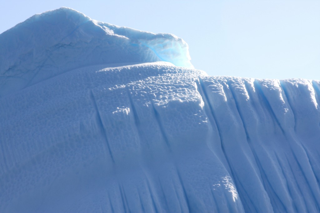
A wall of ice.
At the end of the track, we walked up the morane, gravel discarded by the ice, and down the other side to get onto the ice sheet. It’s now 40 metres lower than it was when the road was built.


Once on the ice sheet, it’s ice as far as the eye can see.


It’s no wonder this is becoming a tourist attraction, although the remoteness of northern Greenland and the trouble and expense of getting here make sure it’s not a destination for mass tourism. But all the guides and tourist people I’ve spoken to confirm that the talk about climate change is attracting more people.
Some say it’s just that people are becoming more aware of the beauties of the Arctic. One guide was convinced a lot of visitors want to see the ice before it dwindles or disappears. It would certainly take a lot to melt this one. But the process appears to be in motion.

Kangerlussuaq

Vuew flying over Greenland to the west coast and Kangerlussuaq.
There would probably be no people here if the US military hadn’t been allowed to build a base here in the 1940s. During the war it played an important role supplying the American forces. It was also an important facility during the cold war. It still has the feel of a base with surrounding camp in the “middle of nowhere”.

The US owned the base until the early nineties, then sold it to the Danes for a token price of one dollar – “as it was”. That included all facilities – and, I was told by a guide here, any pollution, unexploded ammunition etc still to be dealt with. There is a no-go area that’s too risky to enter.
Still, the airport has secured the existence of Kangerlussuaq as a hub for air traffic coming in and out of western Greenland. Tourism is on the increase, according to the official tourism reps, as the settlement – now housing around 400 people – is just 40km away from the inland ice, so a base for trips to the ice and expeditions going out onto it or across it. Still, there is not much in the way of an infrastructure, and it doesn’t make the impression of being a booming “resort” or crowded with visitors. The airport terminal has a “hotel” and a cafeteria like a school canteen. There is one shop and a restaurant with restricted opening hours by Lake Ferguson, a lake above the town where the US forces once had their “rowing club”. There’s also Europe’s 2nd most northerly golf course,(after one in Sweden), but the club house looked pretty shut and there’s not much in the way of greens. Definitely no rival to St. Andrews Royal and Ancient, I’d say. But if you’re up to it, undoubtedly one of the most unusual courses in the world.
I stayed at the “Old Camp”, originally the construction workers’ accommodation, now a hostel with basic facilities, 2.5 km on foot or by hired mountain bike from the airport and various prefab buildings that form the “town”? “Village”?.
NEEM has its headquarters here at the “International Science Support Centre” – a grand name for a long container-building that has offices and accommodation for visiting scientists all in one. NEEM is an international consortium which operates an ice core drilling camp three hours flight out onto the ice. I met Professor Christine Hvidberg, from the ice and climate group at the University of Copenhagen, at the science support centre here. She normally works on ice floe modelling, but she’s spending part of her summer – with husband and four children – running the logistics for the ice core operation here at Kangerlussuaq. All the equipment, and a regular exchange of scientists, have to be flown in and out on chartered American military Hercules planes, big enough to carry heavy equipment and able to land on skis.
The drilling operation is going to drill right down through the Greenland ice, more than 2.5 kilometres at the drilling site, to add to previous ice core drilling operations and find the oldest Greenland ice with the climate records it contains, which will help with models for predicting future developments.

Full background on the NEEM website
Muskox have been introduced to these areas from eastern Greenland, where they are indigenous, as I saw at Zackenberg last week.

We didn’t actually see any today, but since a quota can be legally hunted in this area, unlike the north-east national park where I was before, I don’t blame them for keeping a low profile.
Up on one of the hills above town, I got my first glimpse of the inland ice, apparently towering, shining white in the distance. That’s tomorrow’s programme.

In Kangerlussuaq, my attention was drawn to the problems of building on permafrost – or rather the problems when it starts to thaw, as is happening widely across the Arctic at the moment. The foundations start to sink. The wooden structure at the side of this building is actually a fridge, a cooling system, the rods coming out of the ground are iced over, to cool the permafrost under the structure and re-stabilize the building:

At the far end of the settlement, the huskies who pull sledges in the winter, are sweating in the summer sunshine, without any ice poles to cool them down. It’s around 4 degrees C in the morning (there is a change in temperature between morning and “night”) at the moment, but the round-the-clock sun makes the days feel warm.
Deutsche Welle reporters and Ice Bloggers always get the stories from the lead dog’s mouth:

I couldn’t resist this one:



Feedback