


Search Results for Tag: Greenland
Keeping Greenland in focus

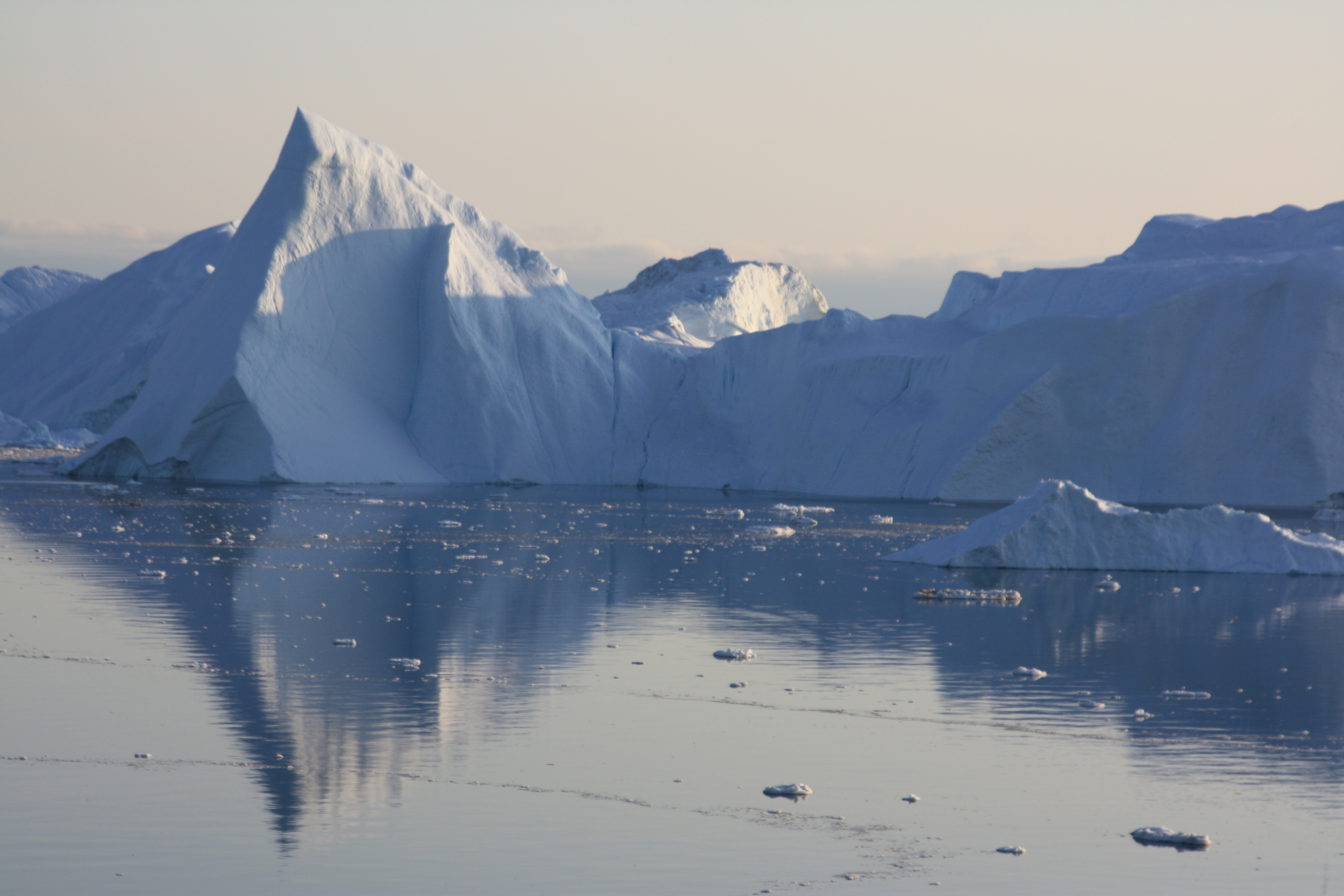
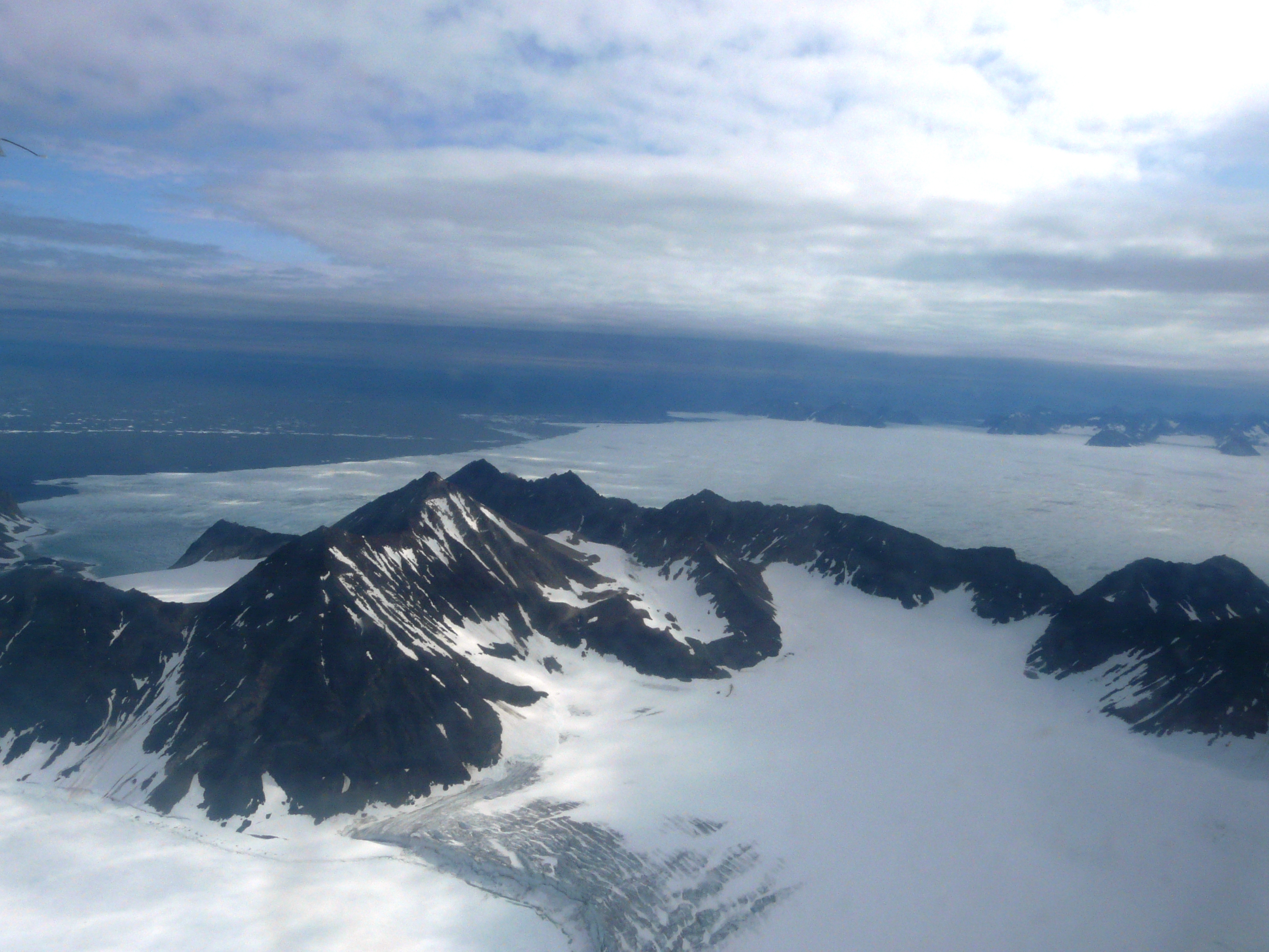
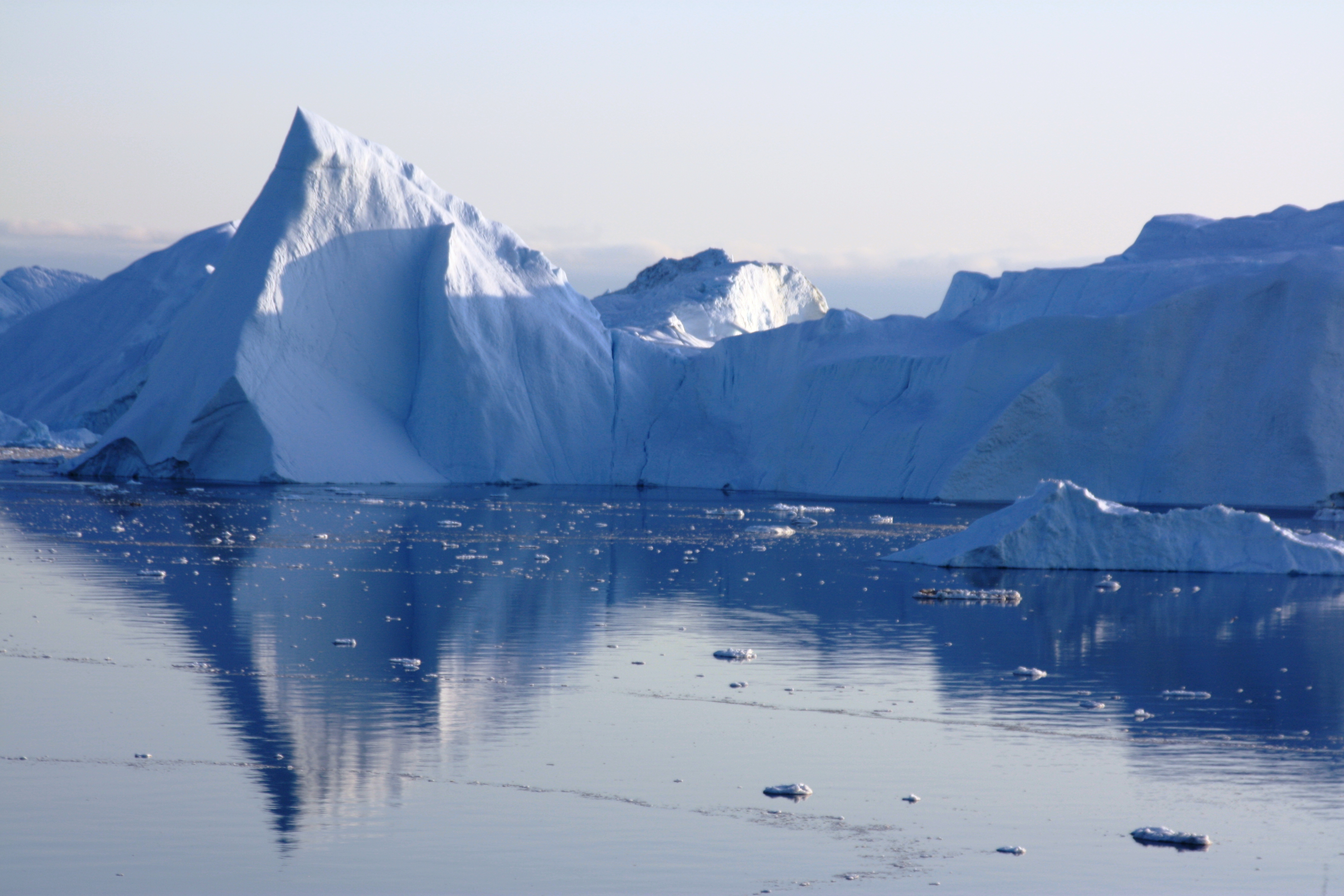
The Greenland ice sheet, photographed 2009 (I.Quaile)
Two interesting publications relating to Greenland caught my eye over the past few days. But it has not proved easy to get them onto the international news agenda. Given the huge importance of the Greenland ice sheet to the planet’s future, this is frustrating to say the least. Fortunately there is the Ice Blog.
The first research relates to a study about the role of ash from fires in bringing about large-scale surface melting. The other predicts Greenland will be a far greater contributor to sea rise than expected.
Let me start with the latter, published in Nature Geoscience. Scientists from the University of California – Irvine and NASA glaciologists have found previously uncharted long deep valleys under the Greenland Ice Sheet. Since these bedrock canyons are well below sea level, they are much more vulnerable to warm ocean waters than previously thought. When warmer Atlantic water hits the fronts of hundreds of glaciers, the edges will erode much further than previously assumed, releasing far greater amounts of water.
Ice melt from the subcontinent has already accelerated, as warmer marine currents have migrated north, the authors say. Older models predicted that once higher ground was reached in a few years, the ocean-induced melting would halt. Greenland’s frozen mass would stop shrinking, and its effect on higher sea waters would be curtailed.
“That turns out to be incorrect. The glaciers of Greenland are likely to retreat faster and farther inland than anticipated – and for much longer – according to this very different topography we’ve discovered beneath the ice,” says lead author Mathieu Morlighem, a UC Irvine associate project scientist, on the university website. “This has major implications, because the glacier melt will contribute much more to rising seas around the globe.”
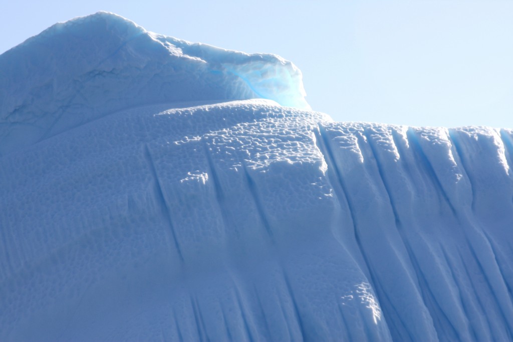
Icebergs from a Greenland glacier melt on.. (I.Quaile)
To obtain the results, Morlighem developed what he says is a breakthrough method that for the first time offers a comprehensive view of Greenland’s entire periphery. It’s nearly impossible to accurately survey at ground level the subcontinent’s rugged, rocky subsurface, which descends as much as 3 miles beneath the thick ice cap.
Since the 1970s, limited ice thickness data has been collected via radar pinging of the boundary between the ice and the bedrock. Along the coastline, though, rough surface ice and pockets of water cluttered the radar sounding, so large swaths of the bed remained invisible.
Measurements of Greenland’s topography have tripled since 2009, thanks to NASA Operation IceBridge flights. But Morlighem says he quickly realized that while that data provided a fuller picture than the earlier radar readings, there were still major gaps between the flight lines.
To reveal the full subterranean landscape, he designed a novel “mass conservation algorithm” that combined the previous ice thickness measurements with information on the velocity and direction of its movement and estimates of snowfall and surface melt.
The difference was dramatic, says Morlighem. What appeared to be shallow glaciers at the very edges of Greenland are actually long, deep fingers stretching more than 100 kilometers (almost 65 miles) inland.
“We anticipate that these results will have a profound and transforming impact on computer models of ice sheet evolution in Greenland in a warming climate,” the researchers conclude.
“Operation IceBridge vastly improved our knowledge of bed topography beneath the Greenland Ice Sheet,” said co-author Eric Rignot of UC Irvine and NASA’s Jet Propulsion Laboratory. “This new study takes a quantum leap at filling the remaining, critical data gaps on the map.”
Other co-authors are Jeremie Mouginot of UC Irvine and Helene Seroussi and Eric Larour of JPL. Funding was provided by NASA.
This is the same team that reported on accelerated glacial melt in West Antarctica, as discussed in an earlier Ice Blog post. Together, the papers “suggest that the globe’s ice sheets will contribute far more to sea level rise than current projections show,” Rignot said.
Indeed. These scientists are telling us the IPCC forecasts were way too low. This could have huge consequences for coastal communities all around the globe.
Unfortunately, a lot of people (even those you would expect to know better) tend to mix up “Arctic” and “Antarctic”. It all goes into the category of “melting ice”, and they think they have heard it all before. What they still don’t realize is that this is something that concerns us all, and that these two polar areas are of huge significance to the world climate as a whole and global sea level. When those two Antarctic studies were released, there was a flurry of news coverage. The challenge for us journalists is how to follow this up and stop the attention curve from dropping.

Plodding on… (I.Quaile)
The other interesting piece of recent Greenland research was conducted by the Dartmouth College Thayer School of Engineering and the Desert Research Institute and reported in the Proceedings of the National Academy of
Sciences. It concludes that ash from Northern hemisphere forest fires combined with rising temperatures to cause large-scale surface melting of the Greenland ice sheet in 1889 and 2012.
The researchers say their findings contradict conventional thinking that the melting was driven by warming alone.
The findings suggest that continued climate change will result in nearly annual widespread melting of the ice sheet’s surface by the year 2100.
Melting in the dry snow region does not contribute to sea level rise, but when the meltwater percolates into the snowpack and refreezes, the surface is less reflective. This reduces the albedo.
Let me give the (almost) last word to the study’s lead author Kaitlin Keegan.
“With both the frequency of forest fires and warmer temperatures predicted to increase with climate change, widespread melt events are likely to happen much more frequently in the future”.
It figures.


![]()
Greenland melt natural or man-made?
Greenland ice sheet (Photo I.Quaile) – melting too fast!
And does it ultimately make any difference? Scientists from the University of Washington (UW) have published a paper in Nature estimating that up to half of the recent warming in Greenland and surrounding areas may be due to climate variations that originate in the tropical Pacific and are not connected with the overall warming of the planet. You can just hear the “I told you so”, from the climate skeptics. “Still”, the UW scientists add, “at least half the warming remains attributable to global warming caused by rising carbon dioxide emissions”.
With all due respect to the scientists who do this essential research – I repeatedly find myself wondering how we can talk about “natural” climate variations at all any more, given that we have changed the parameters so much you could argue none of it is really without human impacts. Does natural fluctuation not act differently if you are starting from completely different base data, brought about by man-made warming through greenhouse gas emissions?
Greenland and parts of neighboring Canada have experienced some of the most extreme warming since 1979, at a rate of about 1 degree Celsius per decade, or twice the global average, the scientists say. “We need to understand why in the last 30 years global warming is not uniform”, says first author Qinghua Ding, a UW atmospheric research scientist. “Superimposed on this global average warming are some regional features that need to be explained”.

Longer enforced holidays for sled dogs? (Quaile, Greenland)
The study uses both observations and advanced computer models. It comes to the conclusion that a warmer western tropical Pacific Ocean has caused atmospheric changes over the North Atlantic that have warmed the surface by about half a degree per decade since 1970. “The pattern of the changes in the tropical Pacific that are responsible for remarkable atmospheric circulation changes and warming in Greenland and the Canadian Arctic are consistent with what we would call natural variability”, says co-author David Battisti, a UW professor of atmospheric sciences.
Of course there will always be natural variability in the course of the seasons and changing meteorological conditions. But in many of the fastest—warming areas on earth, co—author of the new study John “Mike” Wallace, also professor at UW, says global warming and natural variations combine to create a “perfect storm” for warming.
The scientists attribute the natural variations in their study to an “unusually warm western tropical Pacific, near Papua New Guinea. Sind the mid-1990s the water surface there has been about 0.3 degrees hotter than normal. Computer models show this affects the regional air pressure, setting off a stationary wave in the atmosphere that arcs in a great circle from the tropical Pacific toward Greenland before turning back over the Atlantic”. Wallace says there are warm spots where the air has been pushed down, and cold spots where the air has been pulled up. And Greenland, he explains, is in one of the warm spots”.
This and other research by these scientists has documented the existence of decades-long climate variations in the Pacific Ocean which resemble the better known shorter-range El Nino variations. Other studies have indicated that waves starting in the same place in the tropical Pacific but radiating southward are warming West Antarctica and melting the Pine Island Glacier, which has been the subject here on the Ice Blog before.
The experts describe this natural variation as “unpredictable”, whereas the half of the warming in Greenland from the “forcing of climate by anthropogenic greenhouse gases” is “predictable”.
So what do we learn from all of this? One thing is clear. It does NOT change the threat to Greenland’s ice from our man-made warming: “Nothing we have found challenges the idea that globally, glaciers are reatreating, says Battisti. “Ice appears to be exquisitely sensitive to the buildup of greenhouse gases, more than we ever would have thought”, says his colleague Wallace.
Ultimately, the researchers say, natural variations could either accelerate or decelerate the melting rate of Greenland’s glaciers in coming decades. But, “in the long run, the human induced component is likely to prevail”.
So don’t let anybody use this as an excuse to talk down the need to cut emissions in a big way asap.
![]()
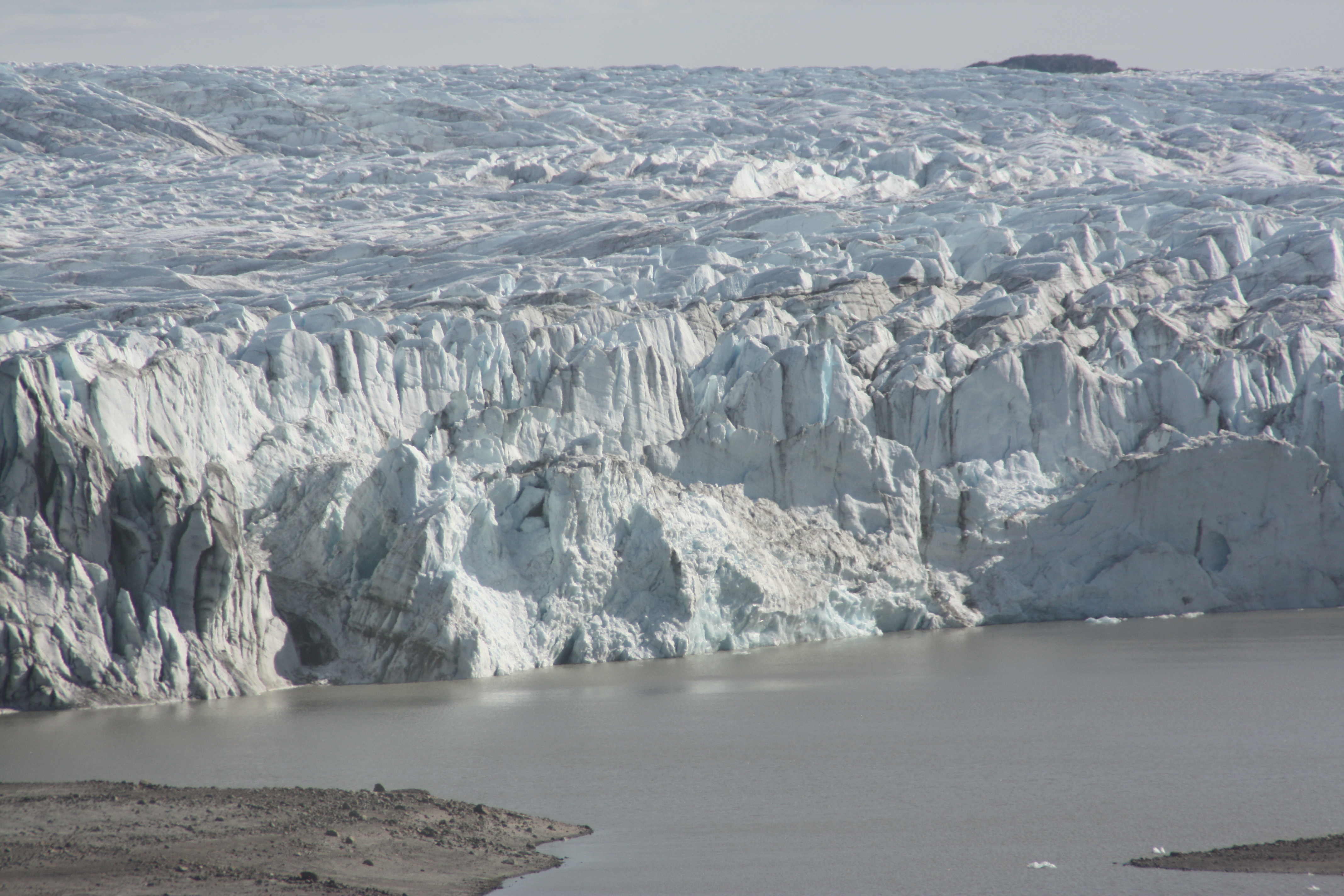
Greenland’s icecap losing stability
Greenland’s massive ice sheet is melting faster than expected, contributing to rising sea levels.
Catching up on the last few weeks of icy news after a spring holiday, my eye was caught by an item by Tim Radford from the Climate News Network, dated April 13th. I quote: “Greenland is losing ice from part of its territory at an accelerating rate, suggesting that the edges of the entire ice cap may be unstable”. This caught my attention not just because anything relating to Greenland tends to do that, but because the development could have major significance for the future world climate and sea level- and because it doesn’t seem to have made its way into the mainstream media at a time when sensitivity to the issue should have been high after the IPCC report.
The Greenland ice sheet is the largest terrestrial ice mass in the northern hemisphere. Radford draws attention to a study in Nature Climate Change by Shfaqat Khan from the Technical University of Denmark and colleagues, which indicates that the ice sheet could be melting faster than previously thought. This would mean Greenland’s contribution to sea level rise has been under-estimated (once again!), and oceanographers may need to think again about their projections.
The scientists used more than 30 years of surface elevation measurements of the entire ice sheet to discover that overall loss is accelerating. Previous studies had identified melting of glaciers in the island’s south-east and north-west, but the assumption had been that the ice sheet to the north-east was stable, Radford writes:
“It was stable, at least until about 2003. Then higher air temperatures set up the process of so-called dynamic thinning. Ice sheets melt every Arctic summer, under the impact of extended sunshine, but the slush on the glaciers tends to freeze again with the return of the cold and the dark, and since under historic conditions glaciers move at the proverbial glacial pace, the loss of ice is normally very slow.”
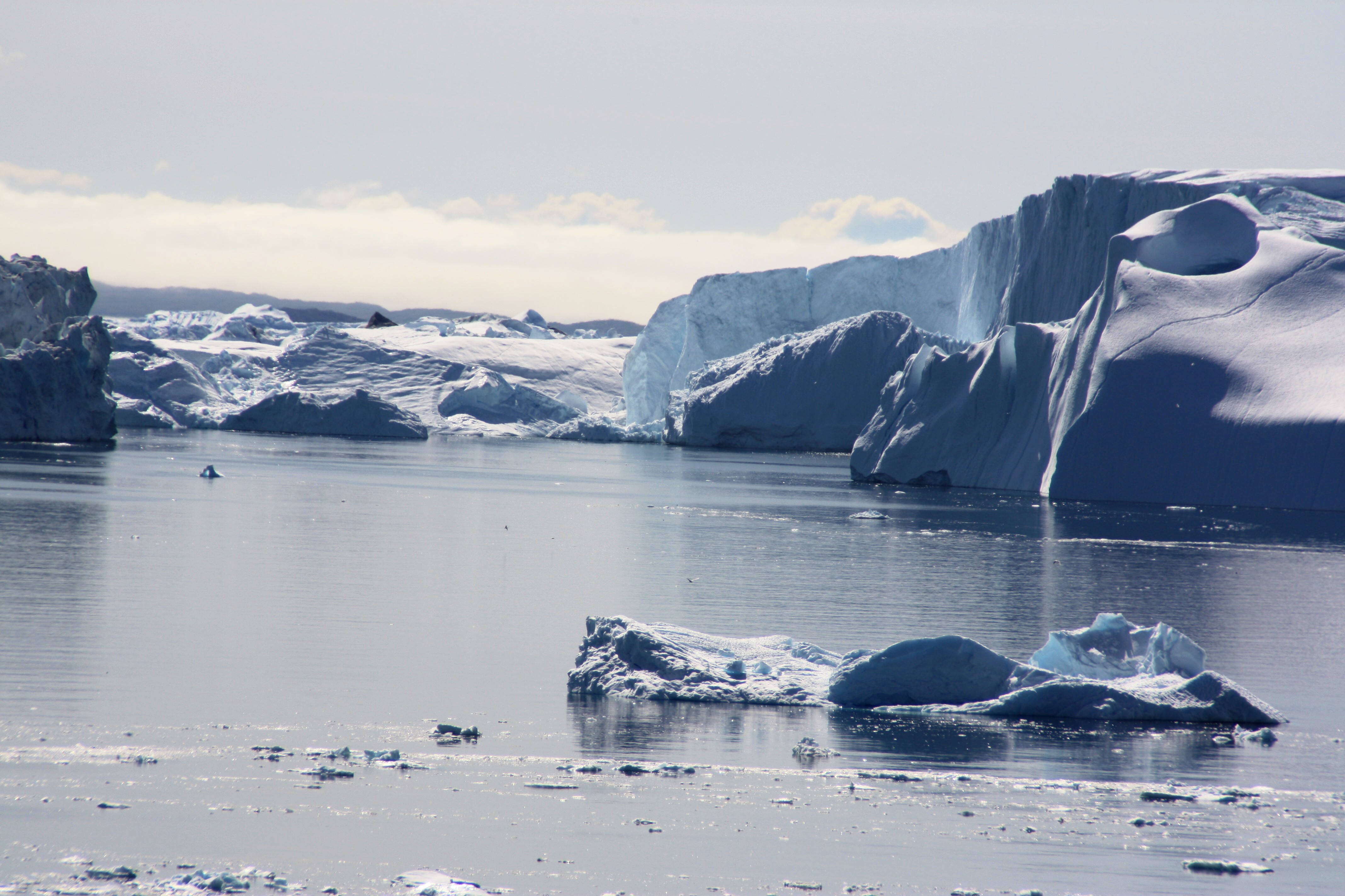
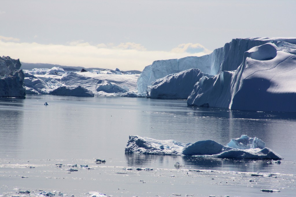
The Sermeq Kujalleq glacier discharges icebergs into the sea (I. Quaile, Ilulissat 2009)
But with global warming, Greenland’s southerly glaciers have been in retreat and one of them, Jakobshavn Isbrae or Sermeq Kujalleq, is now flowing four times faster than it did in 1997. I first reported on this during a trip to Greenland in 2010, and have presented various new studies on it here on the Ice Blog since.
The new research by the Danish-led team considers changes linked to the 600 kilometre-long Zachariae ice stream in the north-east, using satellite measurements. It has retreated by some 20 kilometres in the last DECADE, whereas Sermeq Kujalleq has retreated about 35 kms in 150 years. The Zachariae stream drains around one-sixth of the Greenland ice sheet, and because warmer summers have meant significantly less sea ice in recent years, icebergs have more easily broken off and floated away, which means that the ice stream can move faster. “North-east Greenland is very cold. It used to be considered the last stable part of the Greenland ice sheet,” said one of the team, Michael Bevis of Ohio State University in the US, in an interview with the Climate News Network.
“This study shows that ice loss in the north-east is now accelerating. So now it seems that all of the margins of the Greenland ice sheet are unstable.”
The scientists used a GPS network to calculate the loss of ice. Glacial ice presses down on the bedrock below it: when the ice melts, the bedrock rises in response to the drop in pressure, and sophisticated satellite measurements help scientists put a figure on the loss of ice. They calculate that between April 2003 and April 2012, the region was losing ice at the rate of 10 billion tons a year.
“This implies that changes at the margin can affect the mass balance deep in the centre of the ice sheet,” said Dr Khan. Sea levels are creeping up at the rate of 3.2 mm a year. Until now, Greenland had been thought to contribute about half a mm. The real figure may be significantly higher, according to the report.
This is a very worrying development, but it seems to me it did not get a lot of public attention. This brings me back to the question of the discrepancy between what we know about the impacts of climate change and the widespread lack of political and consumer action. (See my article Denial or Disconnect: Why don’t we act on climate change?)
Are people sticking their heads in the sand (or melting snow)? Have we just been assured so many times that the Greenland ice sheet will never melt that we don’t sit up and take notice? Is it too far away in time and space to bother us? Are too many people giving up and resigning themselves to the fact that climate change is inevitable? Is it just so much easier to hold on to the status quo instead of having to make changes to our 21st century lifestyles?
The Greenland ice sheet, photographed 2009 (I.Quaile)
![]()
Arctic infrastructure cannot keep pace
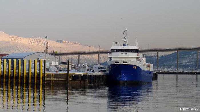
Tromso harbour 2014 (I.Quaile)
The Russian response to Greenpeace’s protest at the Arctic Prirazlomnoye oil rig made it clear to a lot of people that in spite of environmental concerns, the commercialization of the region is proceeding “full speed ahead”and enjoying top political priority. The controversial rig went into production at the end of the last year. Shipping has also increased dramatically in Arctic waters in the last few years, with international freight companies using the Northern Sea Route along the Russian coast to transport gas and other commodities. This reduces the distance between Shanghai and Hamburg by around 6,400 kilometers, compared with the usual route via the Suez Canal. Tourism is also on the up, with an increasing number of cruise ships making their way through Arctic waters during the summer months. What happens if one of these ships sinks? When the Costa Concordia cruise ship hit rocks off the italian island of Giglio in January 2012 and tipped onto its side, the risks of this kind of tourism became graphically clear. The thought of something like that happening with an iceberg in the remote regions around Spitsbergen or Greenland doesn’t bear thinking about. But that, of course, is exactly what we have to do with a view to minimising risks for people and the environment.
The Arctic Institute Center for Circumpolar Security Studies has examined existing infrastructure in the six Arctic coastal states (USA, Canada, Greenland/Denmark, Iceland, Norway and Russia). I attended a workshop as a side-event to the Arctic Frontiers conference in Tromso in January, where the initial results were presented. They should really set the alarm bells ringing.
Kathrin Keil from the IASS Institute for Advanced Sustainability Studies in Potsdam, Germany, looked at developments in the oil and gas sector. She warned that the unpredictability and variability of weather and ice conditions would severely limit the options for responding to an oil accident in the region. The ice cover in May can be between 30 and 90 percent, she explained.
The ice-free period can be as short as one month or as long as nine. To date, there is no adequate technology available to successfully deal with the results of an oil spill in Arctic waters. The Institute also says the ‘Oil Spill Response Plan’ provided by Gazprom for the Prirazlomnoye rig lacks detail. The rig is located close to several nature reserves and Kail warns that these areas would be extremely vulnerable if oil or fuel were to spill. She argues for the tightest possible safety regulations, given that this is the first offshore oil platform to go into operation in the Arctic.
Not enough icebreakers
The existing infrastructure is also inadequate for the increase in Arctic shipping, says Malte Humpert, Executive Director of the Arctic Institute. He says the icebreaker fleet is not big enough to support the growing number of vessels sailing through Arctic regions.
The increase in the number of cruise boats, especially near the Norwegian Spitsbergen archipelago and off the west coast of Greenland, is another cause for concern. If a cruise ship carrying 3,000 people were to collide with an iceberg near the popular tourist town Ilulissat, the existing search and rescue capacity would not be sufficient to cope. The available planes, helicopters and ships would be too few and take too long to reach the accident site, says Arctic Institute’s Marc Jacobsen.
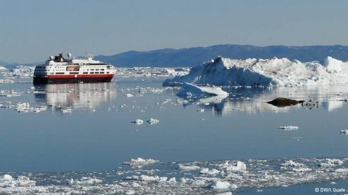
I photographed this ship amongst the icebergs of Ilulissat in 2009
With just 4,500 residents, Ilulissat would be unable to provide adequate medical treatment or shelter for people affected by the crash. Oil and other toxic chemicals dumped by the damaged vessel would be very difficult to clean-up. There is also a shortage of satellite, internet and mobile phone connections, meaning communication would be limited.
Politicians are prepared to take risks
The risks of the increasing commercialization of the Arctic are high on the priority of the region’s politicians, says Magnus Johannesson, Director of the Permanent Secretariat of the Arctic Council . In an interview at his office in Tromsø he stressed to me the importance of ongoing negotiations aimed at introducing a ‘Polar Code’ to regulate Arctic shipping. It is set to come into effect in 2016. Johannesson also referred to the SAREX exercises conducted in 2013. These simulated a shipping accident to test search and rescue capacity. But Marc Jacobsen from the Arctic Institute says the exercise was too small in scale to provide a realistic picture of readiness. There were only 250 people on the vessel used in the mock accident.
“I think everyone is aware that there could be better infrastructure, but these are the first steps,” Johannesson told me . “The Arctic states are very aware of that and doing their best to speed this up”.
Disaster in the Arctic: a possibility
Anton Vasiliev, Russia’s ambassador to the Arctic Council, assumes his country will have proper infrastructure in place along the Northern Sea Route within the next few years. Iceland’s Foreign Minister Gunnar Bragi Sveinsson also told me in an interview in Tromso he was confident that security and response infrastructure would be improved.
“In the end we are always worried about the ocean around Iceland, so the environment and security matter. The possibility of a disaster in the Arctic is why we are paying so much attention to the region,” he told me. “The attention to the economic potential of the Arctic is growing fast. But I don’t think it is moving so fast that we cannot manage it.”
But environmental groups are increasingly concerned about commerical activity in the Arctic. I noticed a distinct lack of ngo participation at the Arctic Frontiers event this year. The price of conference attendance seeems to be one factor that reduces the number of ngo people attending. On the official programme, it seems only one ngo is officially invited to speak each year. This year, it was WWF’s turn, and Nina Jensen the CEO was on one of the panels. I interviewed her in Tromso and she told me: “With the increasing ship traffic, there is a higher risk of accidents and pollution that will impact both humans and wildlife to a very serious extent. We do not know enough about the marine environment to be able to avoid serious impacts. We do not have adequate regulations in place, and there is no sufficient oil spill preparedness.” While she welcomes the Polar Code, she stresses it is only a first step, and fails to tackle issues such as black carbon pollution, invasive species and the use of heavy fuel oil.
She sees a huge discrepancy between the political rhetoric, with politicians all paying lip service to the need for a better infrastructure to protect the fragile Arctic environment, but taking little action to make this happen in time.
We also talked about the huge paradox that is Arctic oil drilling. Climate change is making it possible – and burning oil, in turn, is creating the emissions which cause climate change. The world needs to get away from fossil fuel, says Jensen. The future of the Arctic has to be renewable.
My article on this is on the DW website: Are we prepared for a catastrophe in the Arctic?
![]()
Greenland glacier at record speed
Sermeq Kujalleq glacier at Ilulissat (2009) (I.Quaile)
I have been working on a story about whether the Arctic infrastructure would be able to cope with a shipping or oil spill accident, which is increasingly likely to occur as development speeds ahead. During the Arctic Frontiers conference in Tromso, I attended an interesting workshop on the topic, where the organisers, the Arctic Institute Center for Circumpolar Security Studies, came to what their experts describe as “worrisome” conclusions. Malte Humpert, Kathrin Keil and Marc Jacobsen presented three incident scenarios involving shipping and oil exploration in the Arctic. Jacobsen’s scenario involved a giant cruise boat with 3000 people on board hitting an iceberg off the West Greenland Coast, near Ilulissat.
In 2009 I was in Ilulissat, working on radio features on climate change in Greenland. This is the Greenland of the tourist brochures, with a constantly changing panorama of icebergs floating past your hotel window – or porthole if you are on a ship. While I was there, the fragility of that beautiful glacier ice was brought home to me.

Icebergs off the coast of Ilulissat (I.Quaile)
The Sermeq Kujalleq glacier, also still known by its Danish name “Jakobshavn Isbrae”, is the fastest flowing glacier in Greenland (or Antarctica, these two major ice sources being of key importance to global sea level). The icebergs which create the spectacle floating past the brightly coloured houses of Ilulissat, are breaking off from the glacier. Beautiful to look at, extremely worrying if you think about the background. Back in 2009, scientists were already telling me the glacier was speeding up. Now the latest research published in The Cryosphere (the journal of the European Geosciences Union) confirms that the summer flow of the ice mass has reached a record speed. The scientists, from the University of Washington in Seattle and the German Aerospace Center DLR, say the speeding up in 2013 was 30 to 50 percent higher than previous summers. The scientists analysed satellite images taken every 11 days from early 2009 to spring 2013. Satellite technology plays a key role in observing the ice. Two German radar satellites TerraSAR-X und TanDEM-X provide high resolution data that facilitates precise calculations, according to DLR. One of the authors, Dana Floricioiu from the DLR Earth Observation Center in Oberpfaffenhofen, told journalists it had been striking to see how much the glacier was changing within a very short time.
The researchers found that the glacier’s average speed peaked at 46 metres per day during the summer of 2012. This is the fastest ever recorded for a glacier in Greenland or Antarctica. The big surges take place in summer, but the researchers say the average annual speed of the glacier over the last two years is almost three times what was measured in the 1990s. It is retreating by around 17 kilometres per year. The scientists say these speeds were achieved “as the glacier terminus appears to have retreated to the bottom of an over-deepened basin with a depth of around 1300 m below sea level. The terminus is likely to reach the deepest section of the trough within a few decades, after which it could rapidly retreat to the shallower regions some 50 km farther upstream, potentially by the end of this century”.
The huge volume of ice going into the sea from the Sermeq Kujalleq glacier is already influencing sea level. The glacier drains around 6 percent of the massive Greenland ice sheet Scientists estimate it added about 1 millimetre to global sea levels from 2000 to 2010. The increased speed of the discharge will exacerbate this further.Badnews for people in low-lying coastal areas around the globe. And this is not the only Greenland glacier melting increasingly.
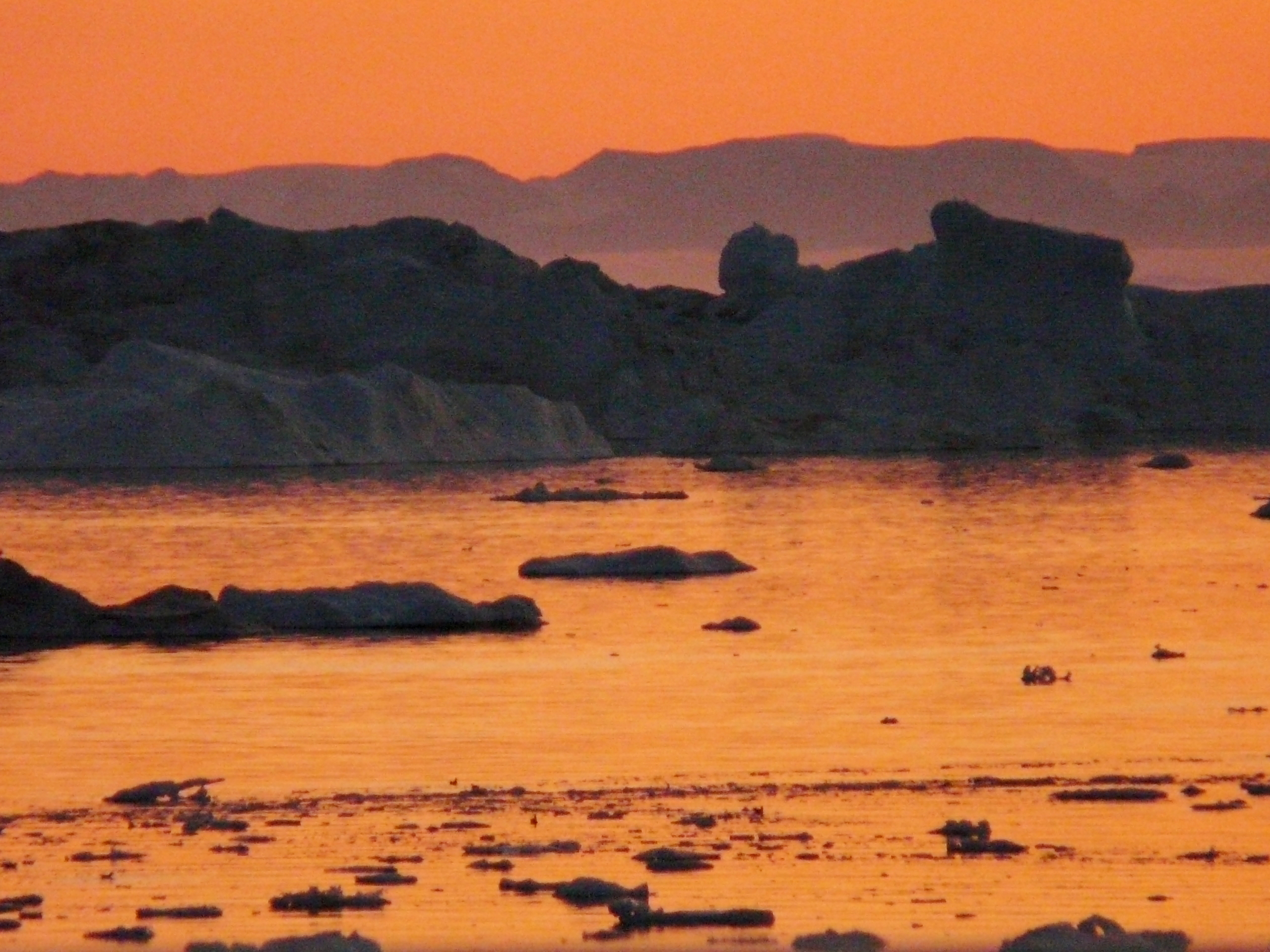
Summer night in Ilulissat
Coming back to the subject of disaster-preparedness – this glacier is thought to be the source of the iceberg that sank the Titanic in 1912. The Arctic Institute’s scenario indicates that an accident like the “Costa Concordia”, which happened in an easily accessible region with no ice or dangerous weather conditions, would have devastating consequences if it happened, say, off the coast of Ilulissat. Search and rescue, accommodation and medical treatment, lack of transport facilities, poor communications infrastructure, no adequate oil spill response technology for icy waters…. food for thought for companies looking to profit from the changing climate of the Arctic – and the governments that should be responsible for protecting humans, wildlife and that beautiful but fragile Arctic ecosystem.
![]()


Feedback