


Search Results for Tag: ice
Ilulissat: the best things in life are free

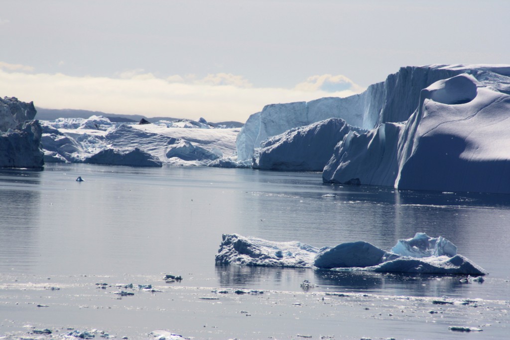
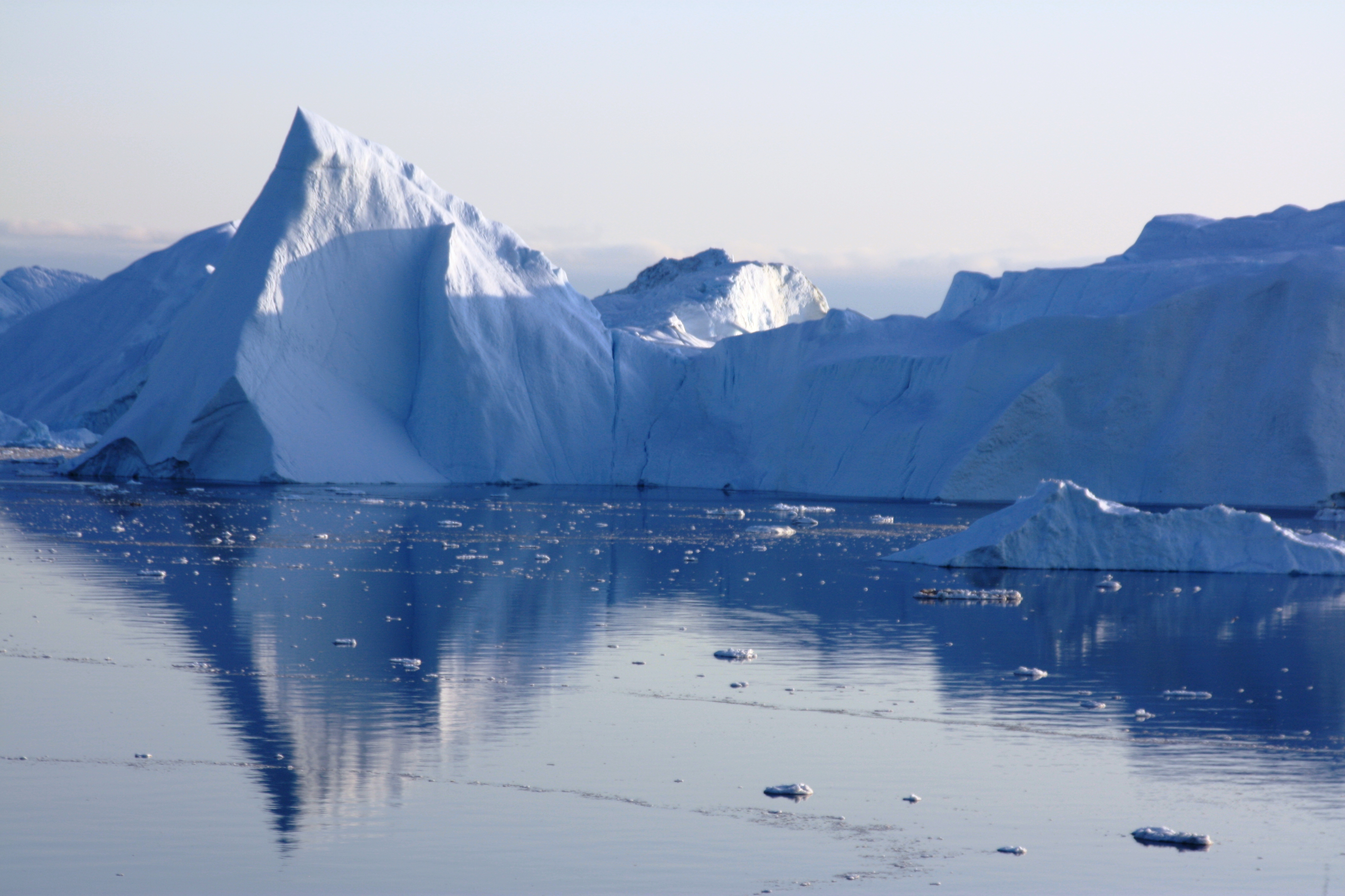
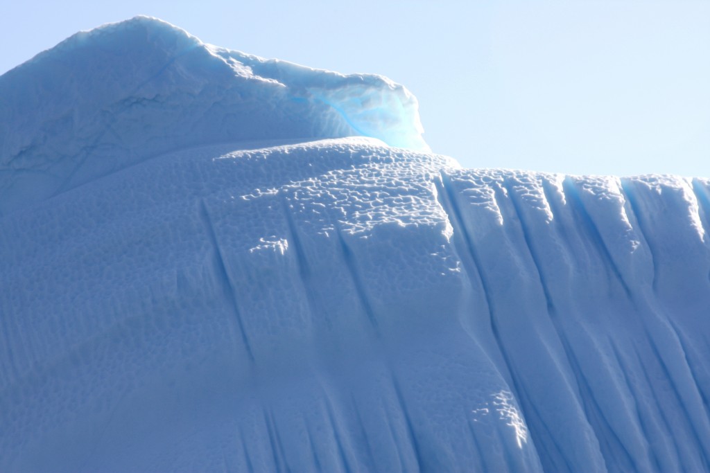
I have now arrived in Ilulissat, which means icebergs in the Greenlandic language. It’s not hard to see why, or why it’s UNESCO World Heritage. The beauty and uniqueness of the icebergs floating around so close made up for some initial problems with the operators who take lots of money to transport people to view the marvels of the site. Fortunately I chanced upon a wooden walkway leading on to a rough trail marked here and there with cairns and yellow dots, which leads over the rocks to the icefjord. I can’t think of a better way to spend an evening than watching the icebergs shift slowly and change colour in the light of the midnight sun.


![]()
On the Greenland Ice Sheet

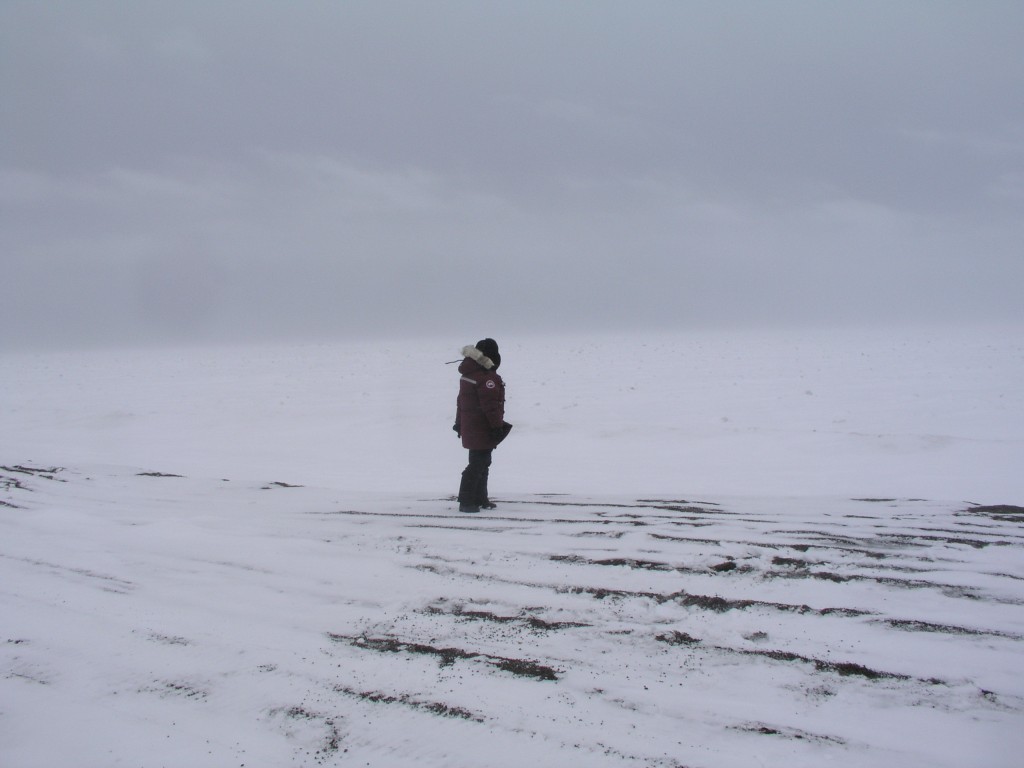
I have been walking on the world’s 2nd largest ice sheet. It would take 30 days to cross it on foot and skis, and it’s almost 3 kilometres thick at its thickest point. It’s hard to imagine that much ice. And to imagine what it would mean for the world’s oceans if it melted. A disastrous 7m rise is the most common estimate, and views on whether or when that might happen vary widely. It’s a complex process, with a lot of uncertainty. But the Greenland ice cap is undoubtedly losing mass overall. And the IPCC predictions have been well overtaken by the current rate of global change.
I drove to the inland ice from Kangerlussaq in a four-wheel drive vehicle. The road was actually financed by the German car company Volkswagen. They decided around 1999 to build a test area for their vehicles on the ice, and this was the access road. (Seems surprising to get permission to build a car test track across the ice sheet in the national park, but there you are).VW stopped in 2005, so did maintenance it seems. Still, with that and the old US base, people have been telling me this area has the most roads in Greenland.
It’s a gravel and sandy track, but 2 hours take you out to the ice and there are spectacular views on the way.(Also muskox and reindeer, but that’s not our subject today).

This is a view on the approach.
It’s strange – the sudden contrast, how Greenland changes from being literally green to icy blue-white:


A wall of ice.
At the end of the track, we walked up the morane, gravel discarded by the ice, and down the other side to get onto the ice sheet. It’s now 40 metres lower than it was when the road was built.


Once on the ice sheet, it’s ice as far as the eye can see.


It’s no wonder this is becoming a tourist attraction, although the remoteness of northern Greenland and the trouble and expense of getting here make sure it’s not a destination for mass tourism. But all the guides and tourist people I’ve spoken to confirm that the talk about climate change is attracting more people.
Some say it’s just that people are becoming more aware of the beauties of the Arctic. One guide was convinced a lot of visitors want to see the ice before it dwindles or disappears. It would certainly take a lot to melt this one. But the process appears to be in motion.

![]()
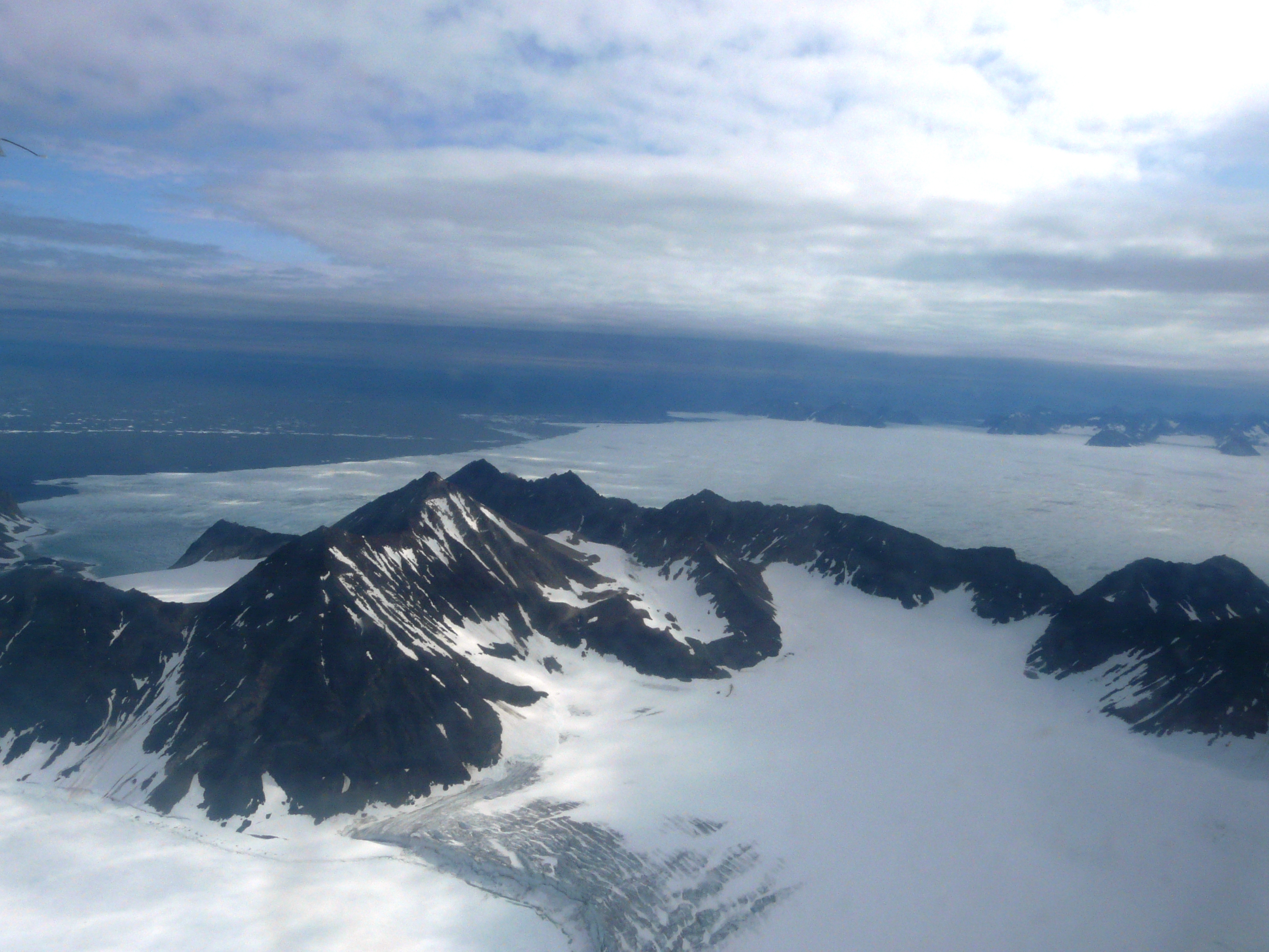
Kangerlussuaq

Vuew flying over Greenland to the west coast and Kangerlussuaq.
There would probably be no people here if the US military hadn’t been allowed to build a base here in the 1940s. During the war it played an important role supplying the American forces. It was also an important facility during the cold war. It still has the feel of a base with surrounding camp in the “middle of nowhere”.

The US owned the base until the early nineties, then sold it to the Danes for a token price of one dollar – “as it was”. That included all facilities – and, I was told by a guide here, any pollution, unexploded ammunition etc still to be dealt with. There is a no-go area that’s too risky to enter.
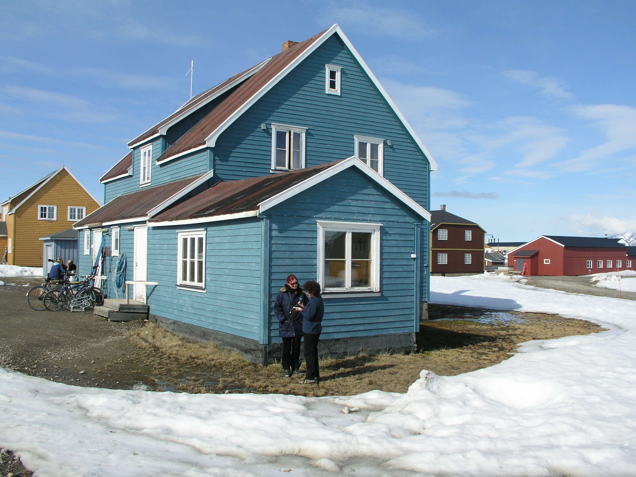
Still, the airport has secured the existence of Kangerlussuaq as a hub for air traffic coming in and out of western Greenland. Tourism is on the increase, according to the official tourism reps, as the settlement – now housing around 400 people – is just 40km away from the inland ice, so a base for trips to the ice and expeditions going out onto it or across it. Still, there is not much in the way of an infrastructure, and it doesn’t make the impression of being a booming “resort” or crowded with visitors. The airport terminal has a “hotel” and a cafeteria like a school canteen. There is one shop and a restaurant with restricted opening hours by Lake Ferguson, a lake above the town where the US forces once had their “rowing club”. There’s also Europe’s 2nd most northerly golf course,(after one in Sweden), but the club house looked pretty shut and there’s not much in the way of greens. Definitely no rival to St. Andrews Royal and Ancient, I’d say. But if you’re up to it, undoubtedly one of the most unusual courses in the world.
I stayed at the “Old Camp”, originally the construction workers’ accommodation, now a hostel with basic facilities, 2.5 km on foot or by hired mountain bike from the airport and various prefab buildings that form the “town”? “Village”?.
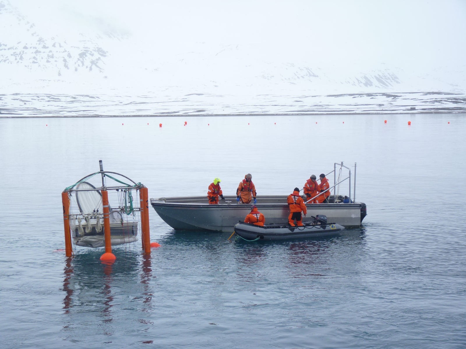
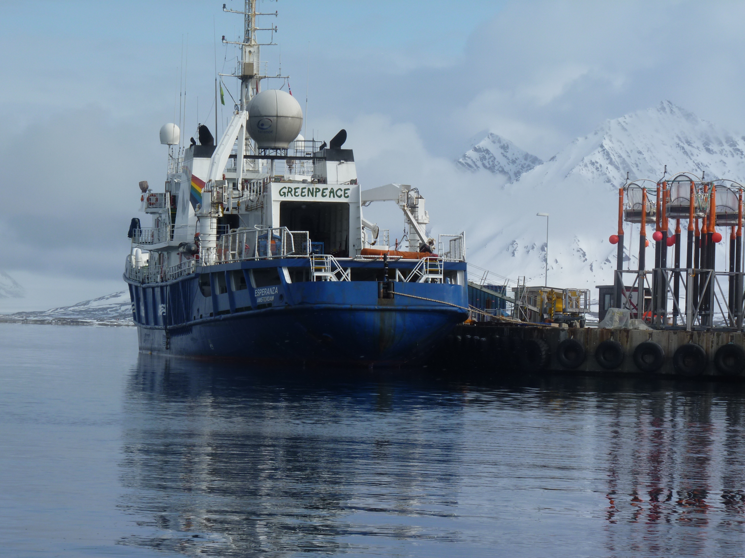
NEEM has its headquarters here at the “International Science Support Centre” – a grand name for a long container-building that has offices and accommodation for visiting scientists all in one. NEEM is an international consortium which operates an ice core drilling camp three hours flight out onto the ice. I met Professor Christine Hvidberg, from the ice and climate group at the University of Copenhagen, at the science support centre here. She normally works on ice floe modelling, but she’s spending part of her summer – with husband and four children – running the logistics for the ice core operation here at Kangerlussuaq. All the equipment, and a regular exchange of scientists, have to be flown in and out on chartered American military Hercules planes, big enough to carry heavy equipment and able to land on skis.
The drilling operation is going to drill right down through the Greenland ice, more than 2.5 kilometres at the drilling site, to add to previous ice core drilling operations and find the oldest Greenland ice with the climate records it contains, which will help with models for predicting future developments.

Full background on the NEEM website
Muskox have been introduced to these areas from eastern Greenland, where they are indigenous, as I saw at Zackenberg last week.

We didn’t actually see any today, but since a quota can be legally hunted in this area, unlike the north-east national park where I was before, I don’t blame them for keeping a low profile.
Up on one of the hills above town, I got my first glimpse of the inland ice, apparently towering, shining white in the distance. That’s tomorrow’s programme.

In Kangerlussuaq, my attention was drawn to the problems of building on permafrost – or rather the problems when it starts to thaw, as is happening widely across the Arctic at the moment. The foundations start to sink. The wooden structure at the side of this building is actually a fridge, a cooling system, the rods coming out of the ground are iced over, to cool the permafrost under the structure and re-stabilize the building:

At the far end of the settlement, the huskies who pull sledges in the winter, are sweating in the summer sunshine, without any ice poles to cool them down. It’s around 4 degrees C in the morning (there is a change in temperature between morning and “night”) at the moment, but the round-the-clock sun makes the days feel warm.
Deutsche Welle reporters and Ice Bloggers always get the stories from the lead dog’s mouth:

I couldn’t resist this one:

![]()
Summer Ice
I have the opportunity to send some of these promised pics, so here they come.


![]()
Late Night Ice
I wanted to go down and look at what’s known as “the harbour”, taking advantage of the long hours of sunlight. Lars, who’s the deputy scientific leader and in charge of the station at the moment, kitted me out with a vhf radio in case of emergencies. I followed “the road” (tracks made by the camp vehicle, a funny contraption with 3 wheels on either side) to the beach of the Sound and was rewarded by finding giant chunks of ice along it and spectacular views of the water in that special deep blue you get in the Arctic summer night.

![]()


Feedback