


Search Results for Tag: Norway
Time to cruise the Northwest Passage?
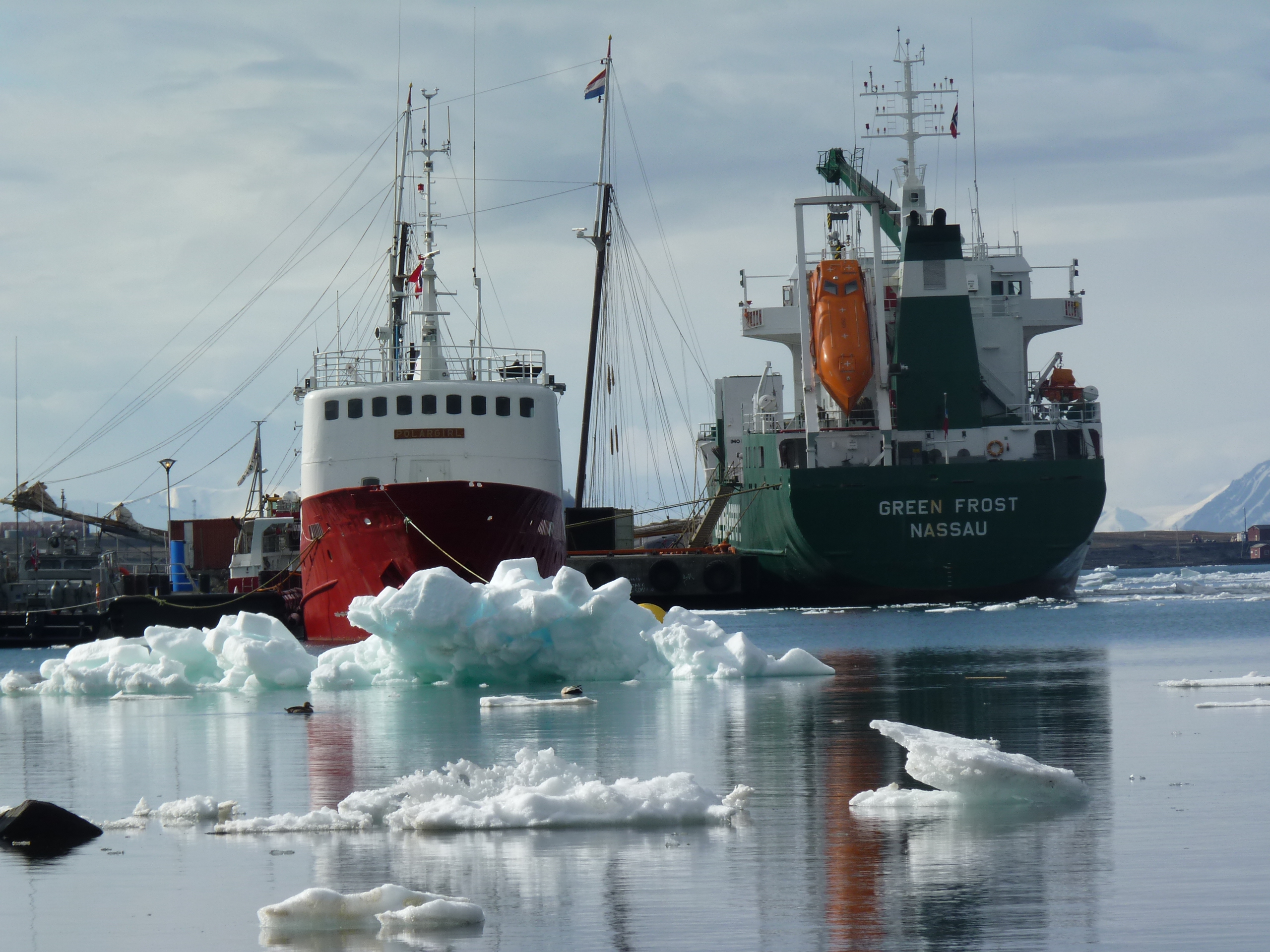
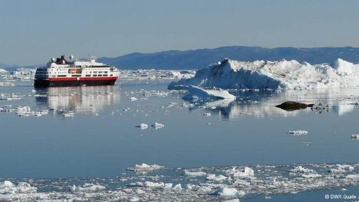
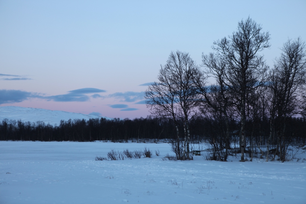
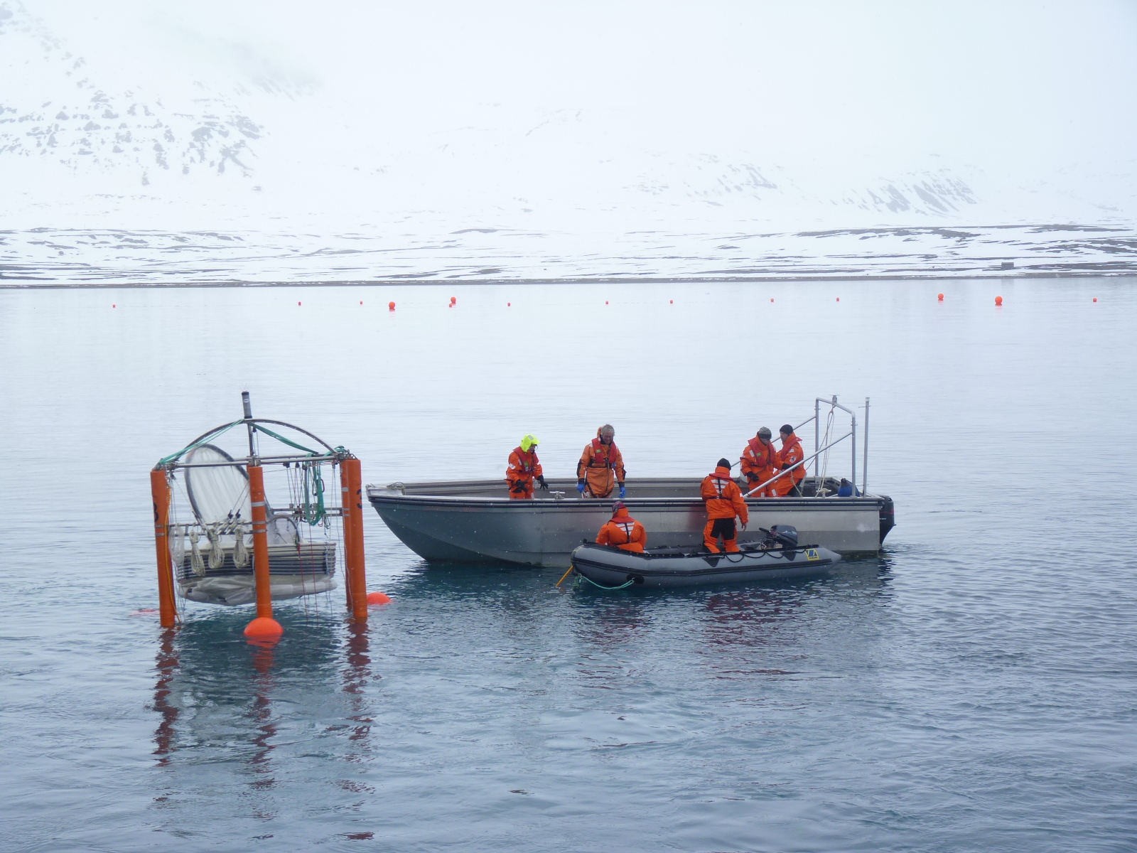
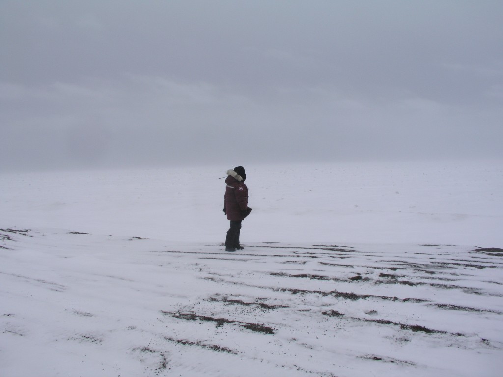
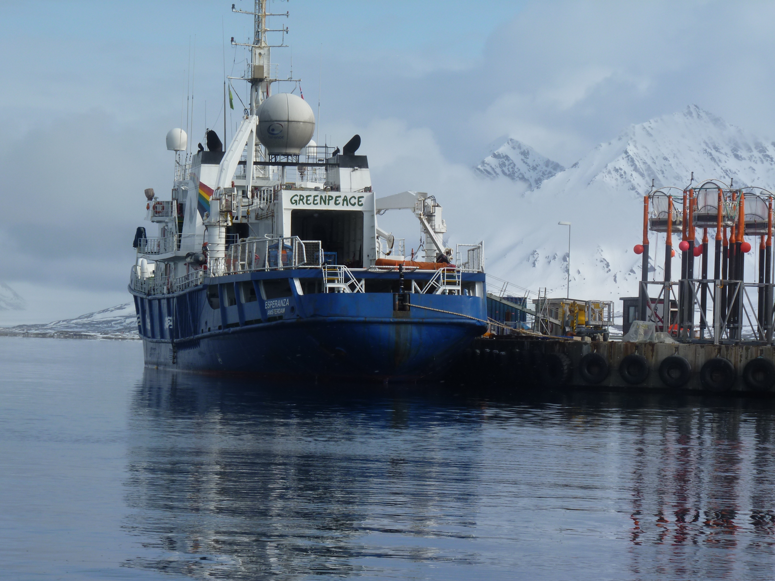
Melting ice, easier ship access (Pic: I.Quaile, Svalbard)
When I came across a story about a sold-out cruise through the North-West Passage planned for this summer on a giant liner carrying around a thousand passengers, I couldn’t help remembering a workshop I attended in Tromsö in 2014, organized by the Washington-based Arctic Institute, Center for Circumpolar Security Studies, within the framework of Arctic Frontiers. I wrote a story afterwards entitled “Are we prepared for a catastrophe in the Arctic?”. The answer I got from the experts was definitely a “no”.
One scenario the experts had worked through made a particularly strong impression on me. It envisaged a cruise ship hitting an iceberg off the coast of Greenland. It was not a happy picture. More people on the ship than in the communities on land, not enough helicopters, not enough accommodation, too little medical capacity, in short a lack of infrastructure to cope, all round.
“A whole new dimension”

Arctic expert Malte Humpert
With the “Crystal Serenity” set to head through the Northwest Passage this August, I decided it was time to call up Malte Humpert, Director of the Arctic Institute, to get his view on the safety aspects of this – and the current state of shipping activities in the Arctic. He said this was a whole new dimension, with almost 2000 people, including passengers and around 600 crew:
“There’s varying challenges, ranging from ice flows to uncharted depths to unpredictable waters, and so the range of risk is pretty high. Of course one can take precautions like ice pilots, having rescue equipment, icebreakers on standby, but you’re still in a very remote area with very small populations, very limited capacity. So the larger these vessels get, the larger the rescue effort would be required to get people safely to land”, Humpert told me.
Just a few years ago, the Costa Concordia disaster made it clear to a lot of people that modern cruise ship tourism has a lot more risks than we might have thought. So what if something like that took place in the remote regions around Spitzbergen or Greenland, where cruise tourism has been increasing, or even in the Northwest Passage? Humpert describes that as “a very horrifying scenario to think about.”
The Arctic is not the Med
“The Costa Concordia was – half a mile or a mile offshore in the Mediterranean, one of the most frequented cruise ship lanes in the world, and even there it took over 50 lives. In the Arctic, if you’re looking at a ship with 1800 people, first of all you’re not in the Mediterranean where waters are rather temperate, and where you have calm seas most of the time. In the Arctic most likely if something goes wrong it’s not going to go wrong on a nice sunny day with 5 degrees Centigrade, it’s probably going to go wrong in really harsh conditions, and suddenly you have a ship with 1500 to 1800 people, most of the people probably elderly, in frigid waters. The largest communities are probably smaller than the amount of people on the vessel itself and even if you have a helicopter or two on standby, how long is it going to take to get those people off the ship?”
Humpert also mentioned an incident involving the “Clipper Adventurer”, which ran aground in the Canadian Arctic on an uncharted rock in 2010. Fortunately, it happened in shallow water, just about three and a half meters deep, Humpert says. “They had the fortunate circumstances that they had time to get people into rubber dinghies and get them to shore. But of course if you’re looking at 1500 to 1800 people, that’s a whole different dimension”, he stressed again.
Of course certain precautions can be taken.
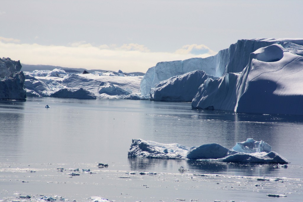
Cruising between the icebergs on Greenland’s west coast is a popular tourist attraction (I. Quaile, Ilulissat )
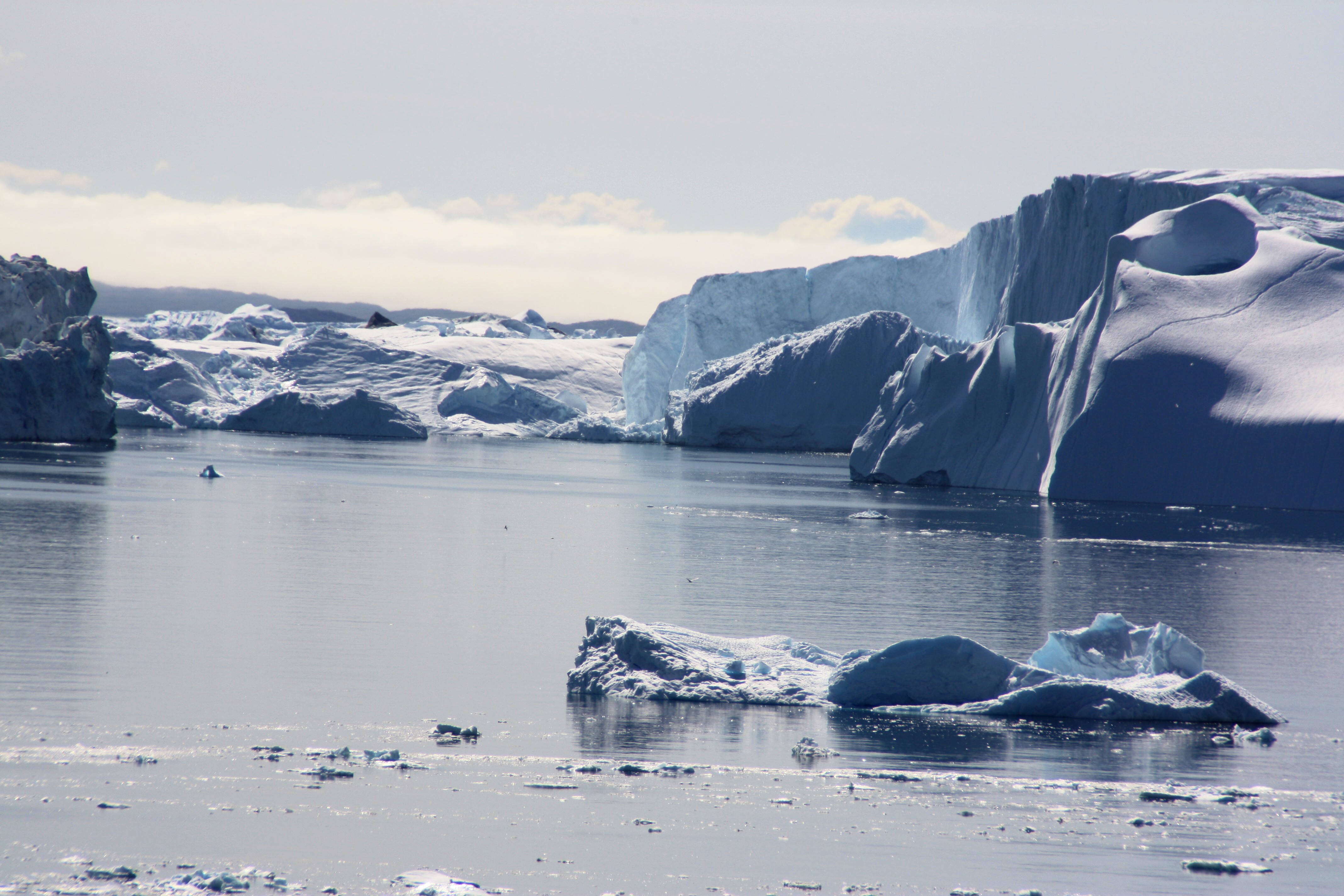
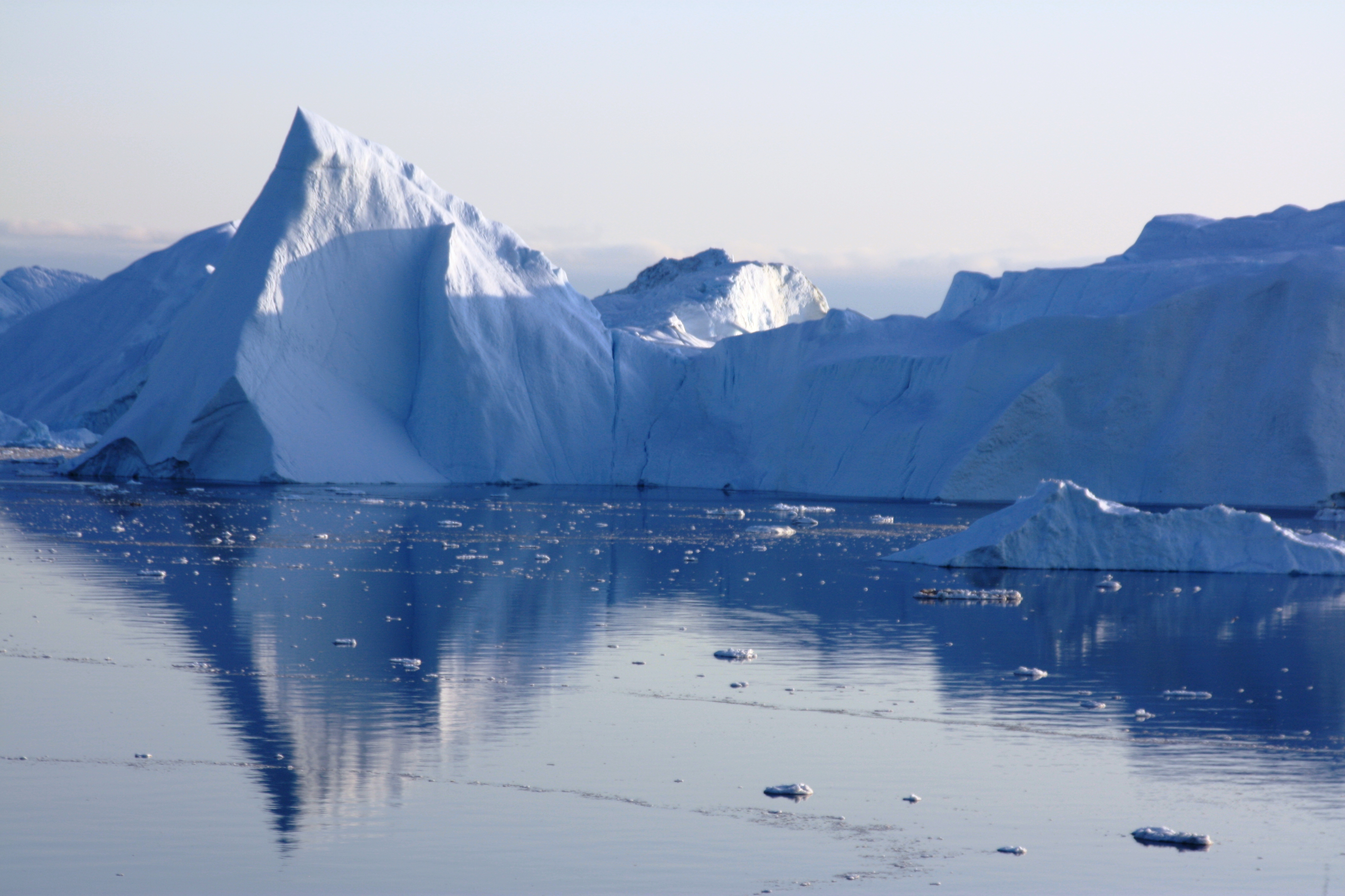
“The Danish coastguard along the west coast of Greenland requires cruise ships that go into Disko Bay and Iceberg Ally on the west side to go in pairs. They have to stay within a certain distance of each other when they go into ice-infested waters , just so there is actually a second floating platform that could take aboard these people if one of the cruise ships were to get into trouble. That in my opinion is one of the largest risks. Yes, you can have all the equipment on standby, you can have ice pilots along, but if something does go wrong and you need to get people off the ship quickly – the quickly part is the problem. And where do you put those people?”
Too big to sink?
With all of this, the problem is the huge size of today’s cruise ships. The thought of almost a thousand people converging on a small, remote Arctic community is one I personally find most unattractive. (That is an example of the British art of understatement.) Humpert stresses even when cruise ships go into regular ports, they have to take people ashore in groups.
With this first trip by a giant liner through the Northwest Passage, he reckons all possible precautions will be taken. But if the voyage works well, the danger is that more and more companies will want to follow suit and send large vessels up there.
“Then suddenly we might have lower budget cruises that don’t take the necessary precautions. With higher frequencies of these voyages, the risks definitely go up.”
Tromso harbour (I.Quaile)
After this record warm winter and the huge decline in the amount of sea ice in some regions of the Arctic, my feeling is that people can be lulled into a false sense of security, when they hear about a “warming Arctic”. Malte Humpert agrees.
“Whenever people read in the headlines “ice-free Arctic,” it kind of makes it sound like the Arctic is now your local pool or the Mediterranean, suddenly. The Arctic is still a very harsh environment. Just because the ice is melting during the very short summer season and because of this “warming” – that does not mean its suddenly warm – it’s still a very harsh environment and you forget that small mistakes in the Arctic can rather quickly become very deadly mistakes.”
The highest risk, according to the Arctic expert, is that people forget that a cruise in the Arctic can be a dangerous endeavor. “If everything goes well it would probably be the experience of a lifetime, but small errors can quickly become insurmountable in the Arctic”.
Northwest Passage – international waters
When it comes to regulating shipping in the region, Humpert notes that the Northwest Passage is considered an international strait. That means as long as commercial vessels or cruise ships have international certificates of transit, they are allowed to go through.
“Canada can require that vessels abide by environmental regulations, that they take on board ice pilots, the coast guard can prescribe certain routes. If they see that some channels along the Northwest Passage have too much ice, they can require cruise ship to go a different route. But in general, the Northwest Passage is accessible to anyone. And of course the more activity you have, the harder it becomes to ensure that environmental regulations are abided by, that accidental spills or other mishaps don’t occur in the Arctic, and so its a very careful balance between allowing these first business ventures to head up into the Arctic and at the same time fulfilling these pledges we have seen over the last five to ten years that the Arctic is a pristine environment and should be protected”.
I am deeply concerned that climate change is opening the Arctic so fast that it’s hard for environmental protection and safety measures to keep pace. Humpert says it’s always difficult for policymakers to keep up in cases like this. But he is full of praise for the oil spill and search and rescue agreements drawn up by the Arctic Council. The question is whether the assets and infrastructure are there to implement them. Icebreakers???

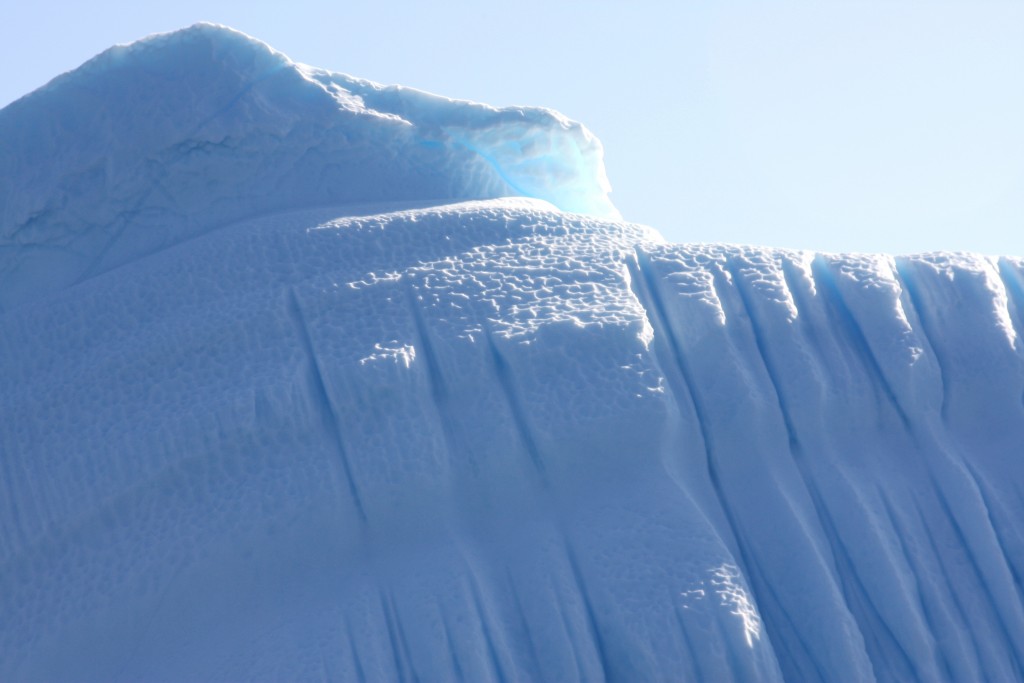
The tip of the iceberg (Pic: I.Quaile, Greenland)
The cheap fuel paradox
Aside from the issue of cruise ship traffic, international freight companies have used the Northern Sea Route along the Russian coast in recent years to transport gas and commodities, reducing the distance between Shanghai and Hamburg by around 6,400 kilometers compared with the Suez Canal Route. .
Humpert’s Arctic Institute recently conducted a study on the feasibility of the Northern Sea Route for different types of shipping, compared with the other route.
The study includes a calculator, in the form of an online tool, and allows for variables such as vessel size, ice class, distance, ice extent, fuel price, average speed, NSR fees, etc., to give a very detailed calculation of what type of transport would be economically feasible. The tool illustrates how cost curves change depending on the amount of ice, size of the vessel and the price of fuel. The calculator even takes into account ship hull designs to calculate costs.
“In 2012 and in 2013 we saw quite a bit of traffic going through the Northern Sea Route, about 70 ships in 2013 was the peak. That’s still very small compared what goes through the Suez Canal, where we see around 16, 17, 18,000 ships passing through a year. What our study in cooperation with the Copenhagen Business School Maritime Center shows, is that the key factor is fuel prices. So if fuel prices are very low then those shortcuts don’t really pay dividend for shipping companies”, Humpert told me.
I was quite shocked by one fact he drew my attention to. At the moment oil prices are so low that a lot of shipping companies are choosing not to go through the Suez Canal any more. Instead, they take the long way round, choosing to go around the Cape of Good Hope at the southern tip of Africa. Humpert says this adds 3500 miles to their journey and about 10 or 11 days of sailing time. It seems that they still save about 350,000 dollars on average by not paying transit fees for the Suez Canal.
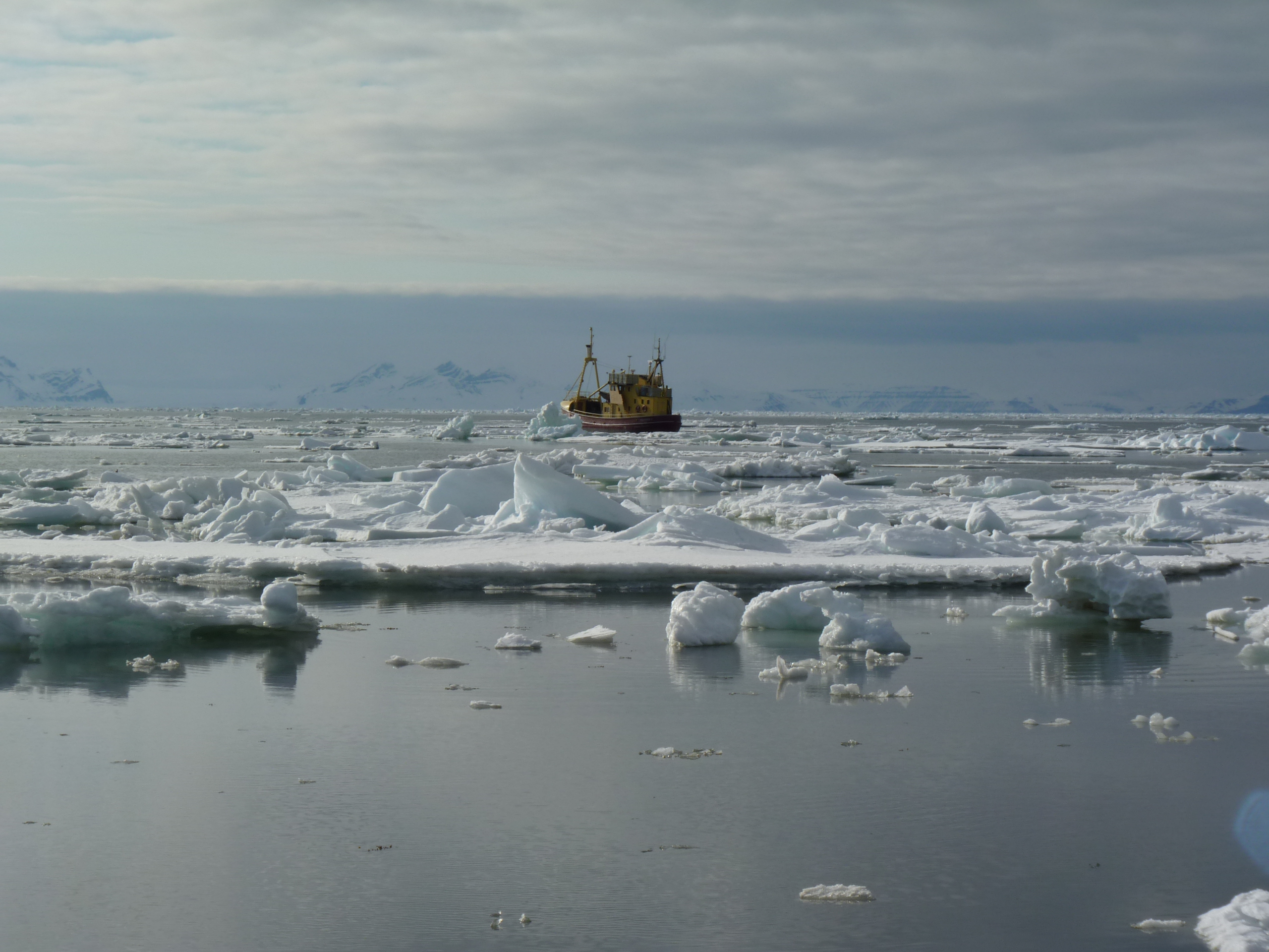
Shipping in icy waters is never completely risk-free. (Svalbard, Pic: I.Quaile)
The environmental and climate costs of the extra fuel burned clearly just do not feature!
This also has implications for the Northern Sea Route, says Humpert.
“You need special insurance, you need ice breaker escorts which are quite costly, you need to pay transit fees to the Northern Sea Route Administration. So it’s an interesting calculation”. The experts come to the conclusion that sometimes, for some shipping operators, at some time of year or in a given year when certain conditions are right, it may be economically feasible to go through the Northern Sea Route. At other times it may be more prudent or more economical to use the Suez Canal.
“Currently, the Northern Sea Route is a very specialized shipping environment. Very few operators have looked at it, and those that tried in 2013 haven’t really come back. Last year we only saw 19 ships go through the Northern Sea Route and very, very limited cargo volumes. It will be interesting to see what happens this year as we have a new record ice low in January and February. It could be that we are heading for that kind of ice-free season where two or three months of the year you really have a practically ice-free Northern Sea Route, which would start to alter the economic calculations. But the fuel price would certainly have to be higher”.
So we seem to be caught in some kind of a vicious circle. If the fuel price stays low, the Arctic will be saved for some time from increased freight traffic along the Northern Sea Route. But the price is increased emissions from the burning of all that extra cheap fuel. And that, as we know, heats up the climate further and melts ice, making it easier for shipping of whatever form to head into Arctic waters. If the fuel price goes up, companies will be keener to make use of the shorter Northern Sea Route. Unless there is some kind of miraculous, unexpected planetary cool-down somewhere in the pipeline, I can only conclude that increased shipping and the risk of a potentially catastrophic oil-spill or other incident in Arctic waters are only a matter of time.


![]()
Trudeau and Obama’s Arctic Endeavours
Obama and Trudeau want to protect the Arctic against climate change and harmful development (Pic: I.Quaile
Sometimes there are pleasant surprises to end the week. An announcement by the US and Canadian leaders that they are joining forces to take measures to protect the Arctic would come into that category.
Given the US role as a top emitter and Canada’s extremely negative position on climate action under the old Harper government, this seems to me a very important announcement. Obama, unfortunately, is on his way out. Trudeau, we know, has just come in.
I was interviewing Frida Bengtsson from Greenpeace on the phone this morning about a campaign to keep industrial fishing out of the Arctic. I asked her how she judged the announcement. This was her response:
“I think it shows some good, clear leadership on Arctic protection. Now it’s up to the implementation. We’re hoping they will set the bar really high on protection and that fishing will be included and that areas of the Arctic will be off limits to any industrial activity, including oil and gas.”
As always, the proof of the pudding is in the eating.

Keeping a wary eye on the politicians (Pic: I.Quaile)
In the background, the two countries have pledged to sign the Paris climate deal “as soon as feasible”. Hm. That sounds a little wishy-washy to me. But they also say they want to improve cooperation on energy issues. If it means cutting emissions rather than building something like the Keystone XL crude oil pipeline to bring heavy Canadian oil to the US, it’s extremely good news for the climate. Obama rejected the project last year. It was promoted by Trudeau’s predecessor, Stephen Harper.
Canada and the USA have now committed to cut emissions of methane by 40 to 50 percent below 2012 levels by 2025. Given that methane is around 20 times more powerful than CO2 as a greenhouse gas, that is an important step. The oil and gas industry is the single largest source of methane emissions in the US and globally. Obama and Trudeau also announced they plan steps to fight climate change in the Arctic, and to speed development of green technologies.
The US Environmental Protection Agency, EPA is to start developing regulations for methane emissions from existing oil and gas sources immediately and “move as expeditiously as possible to complete this process”. Obama has made extensive use of the EPA during his time in office, in his attempt to combat opposition to his pro-environment and climate moves from Republicans.
Last month the US Supreme Court ruled to delay the implementation of Obama’s Clean Power Plan to fight emissions from power plants. But the President says the plan to cut methane emissions is on secure legal grounds.
In the Arctic, the countries agreed to set standards on shipping, fishing and oil and gas exploration and development, and to base decisions on scientific evidence. Development is only to occur “when the highest safety and environmental standards are met”.
In the Washington Post, mark Brownstein, vice president of climate and energy at the Environmental Defense Fund, said the proposed cut in methane emissions would be like “closing a third of the world’s coal plants”.
“This is arguably the single biggest, most impactful, most immediate thing we can do to slow the rate of warming right now”, Brownstein said.
Obama and Trudeau pledged to safeguard the Arctic with initiatives to protect more than 10 percent of the marine areas, designate shipping corridors with low environmental impact, and establish new offshore oil and gas leasing plans.
Clearly, both governments are recognizing the Arctic as a priority. Of course full Arctic protection requires action by other Arctic nations, like Russia, Denmark and Norway.

Shipping is risky in the cold, dark, Arctic (Pic: I.Quaile)
Increasing industrial activity in the Arctic brings an increased risk of potential collisions, oil spills, pollution, black carbon and underwater noise to disturb wildlife.
This joint announcement is a clear demonstration of how much political leadership can do when it comes to climate issues,and just how important is to have people in power who understand what drives climate change and why it is dangerous, and are willing to commit to climate action in the face of opposition from fossil-fuel-based industries, demonstrating at the same time that climate protection is actually good for the economy.
I interviewed Alexander Ochs, Senior Director for Climate and Energy at the Worldwatch Institute recently about implementing the Paris Agreement and the “Energiewende”, the transition to renewable energy. We also discussed the US position on climate.
“If we talk about the US, there is not one US player. Unlike many other countries where there is a consensus across parties, across people of different ideologies, that does not exist in the US, it’s a highly partisan issue. Candidates for presidency and US congress take positions almost exactly along party lines.”
Clearly, the result of the US presidential election will have major implications for climate action.
“The results of the elections on the federal level, as well as their impact on international cooperation on climate and energy, will be very dramatic. Having said that, even under Republican leadership, – which would have dramatic impacts – there will be many actors in the United States that will continue their action on the ground. Whether it’s municipalities or cities –more than a thousand mayors are supporting the Kyoto goals for example, widely unnoticed by Europeans – or on the state level, or individuals. So you do see a lot of things happening on the ground in the United States, so it’s often unfair to these people if we reduce the US to the presidency.”
That is an encouraging thought. Leadership is essential. But so, too, is action from the bottom up.
![]()
Arctic Winter Impressions
Your Iceblogger is off on a hard-earned break for the next few weeks. I’d like to leave you with some photographic impressions of my winter trip to the Arctic. Thanks again to Norway’s Arctic University in Tromso and the organisers of Arctic Frontiers for the opportunity to visit Svalbard and Tromso at this fascinating time of year. Look out for the next post in April, when spring should be well underway.
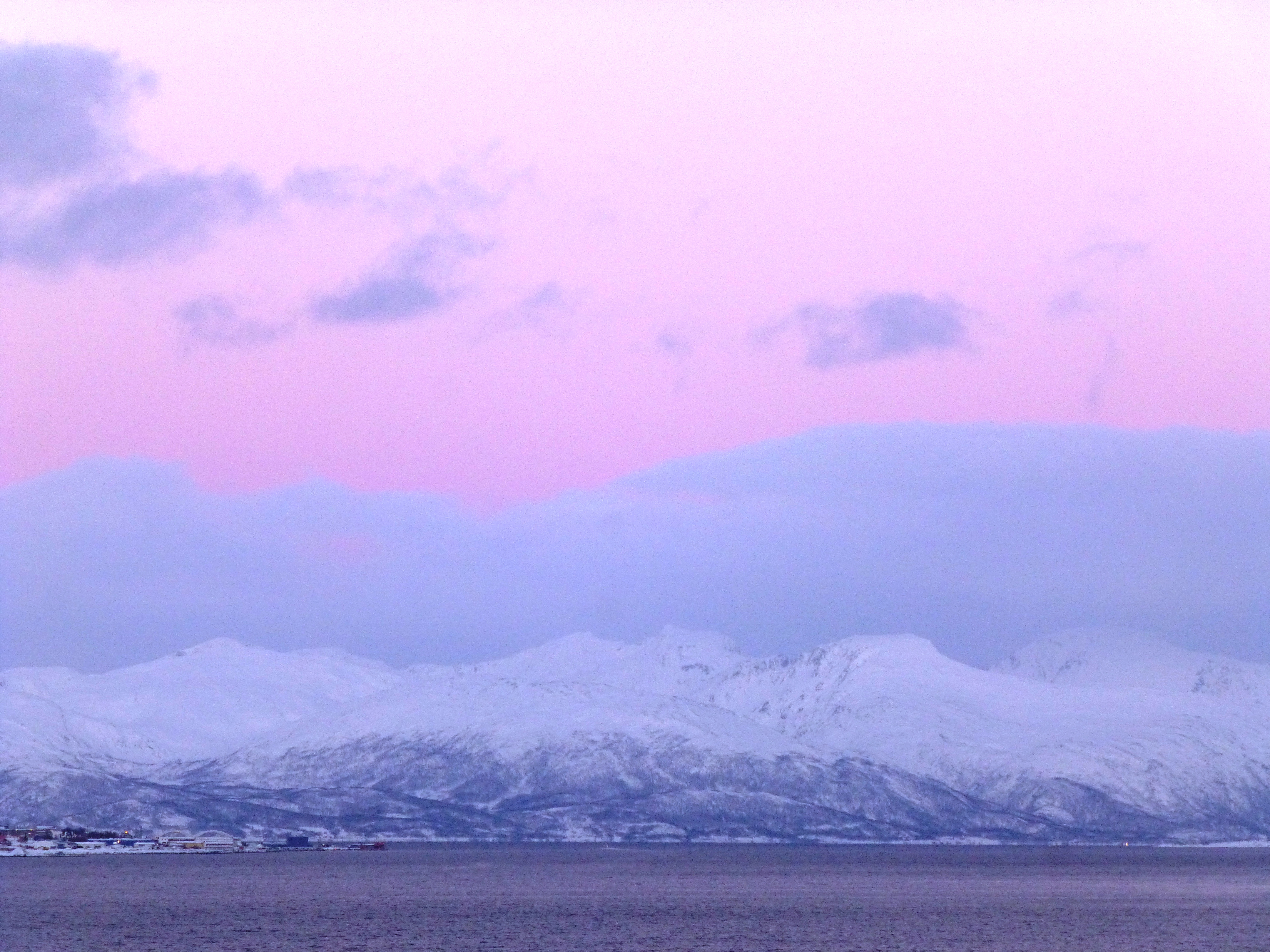
Shades of winter Tromso
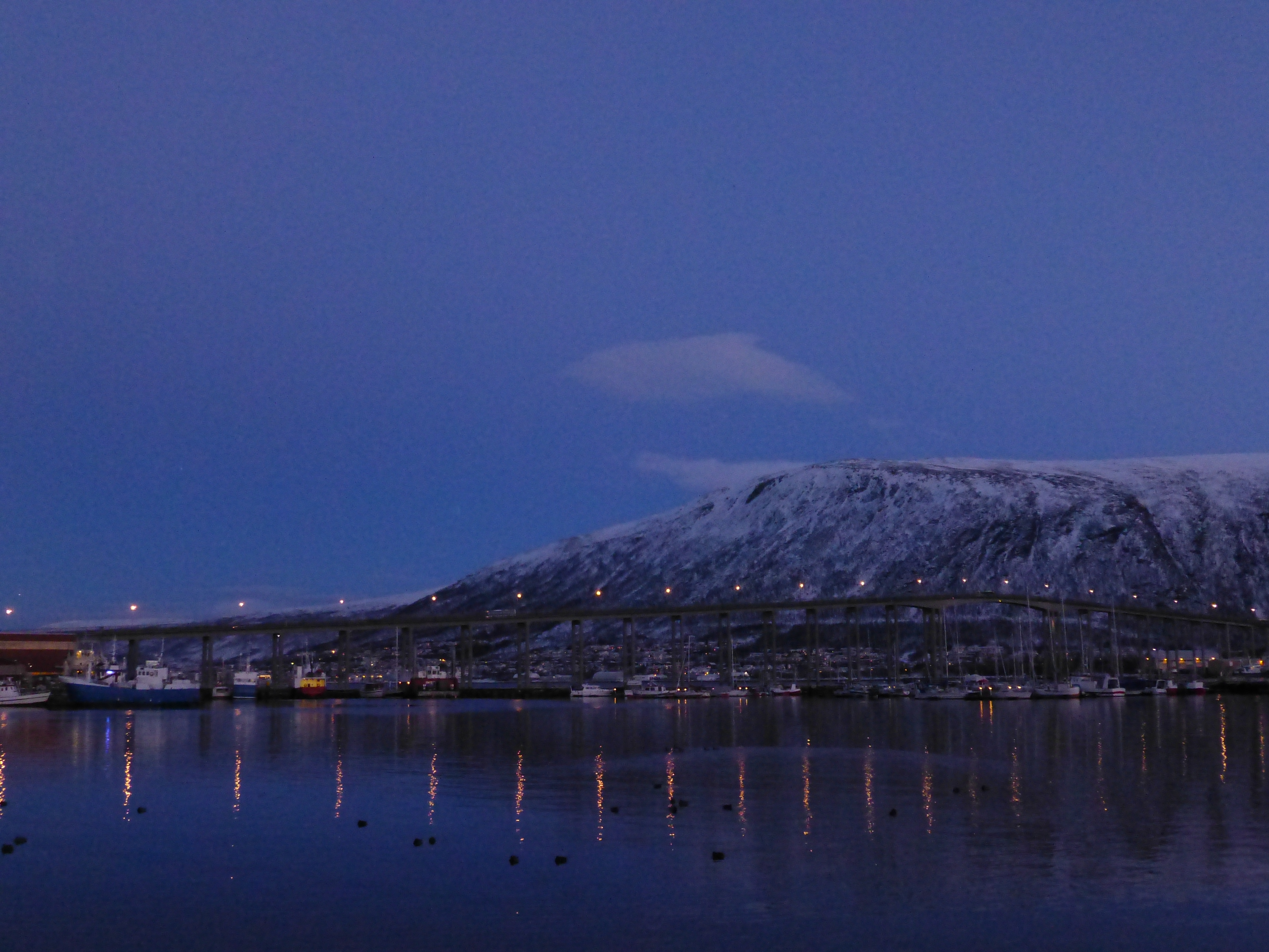
Norway’s “Arctic hub” by night
Resident of the Tromso Fram Centre!
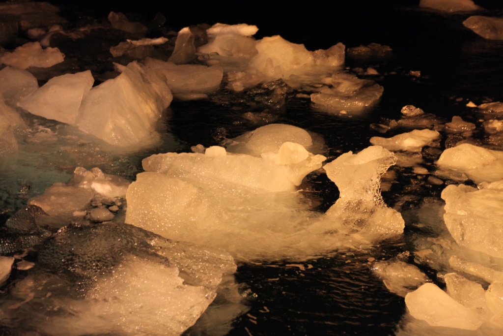
Ice floats in Kongsfjorden, Svalbard
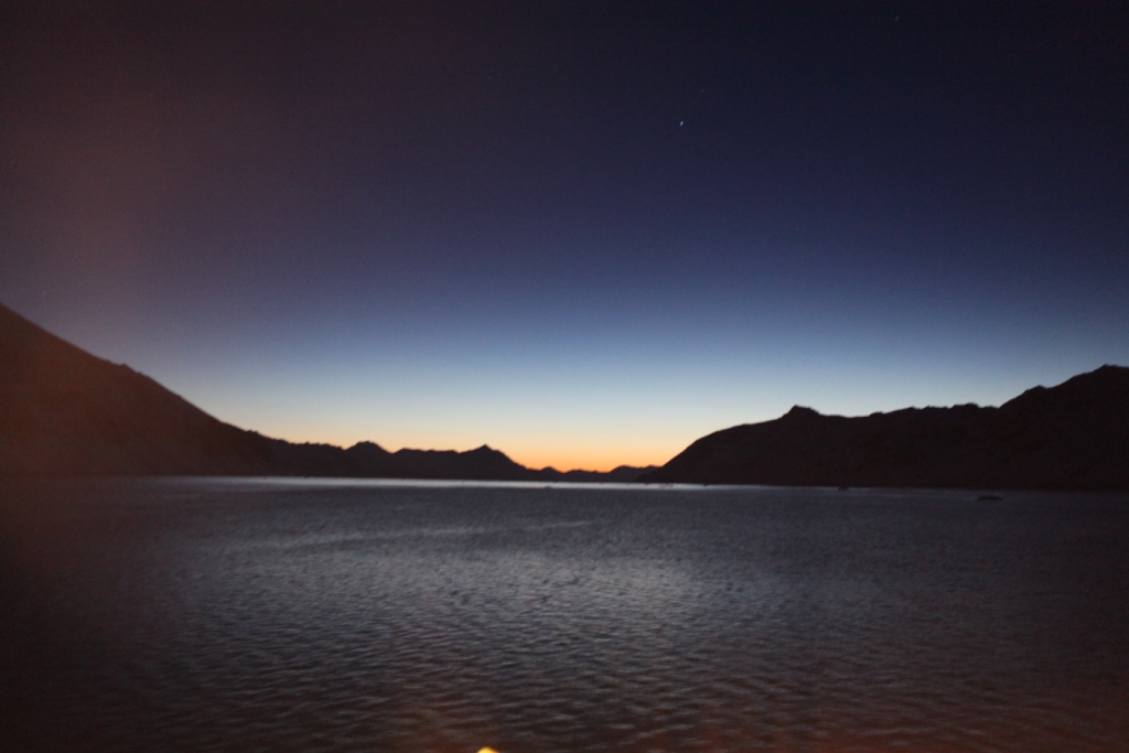
Svalbard twilight
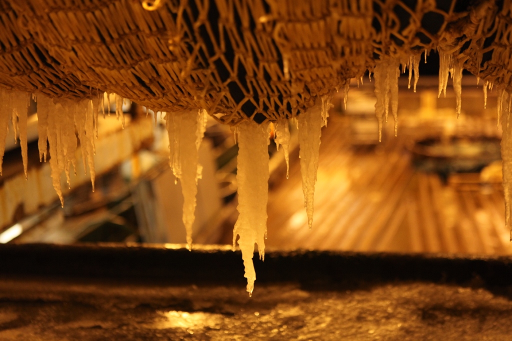
- Icicles on the nets aboard the Helmer Hanssen
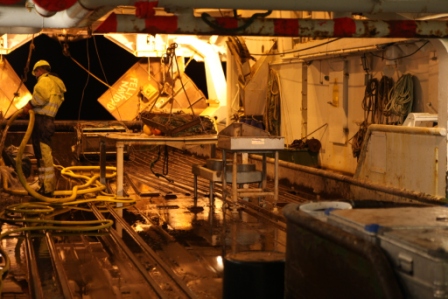
Cleaning the trawl deck of the RV Helmer Hanssen
“Here’s looking at you, kid!”
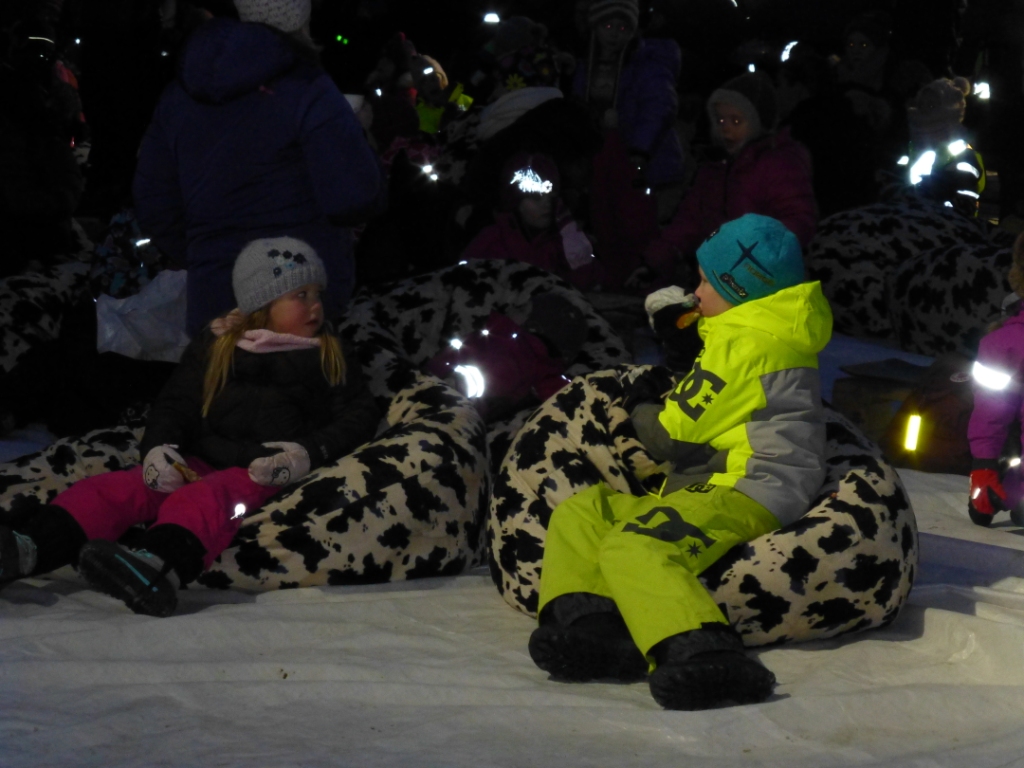
Young film buffs at Tromso Film Festival
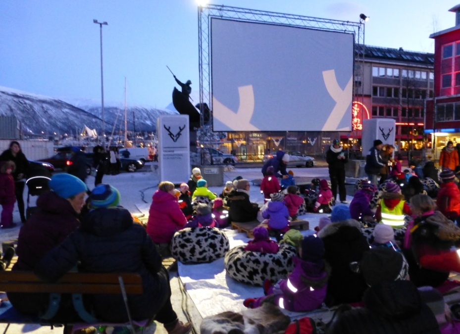
Outdoor cinema, Arctic style
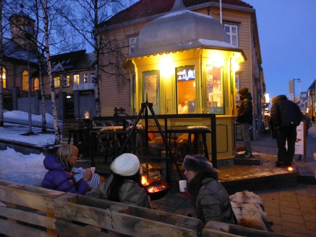
Hot drinks and snacks in the film festival café!
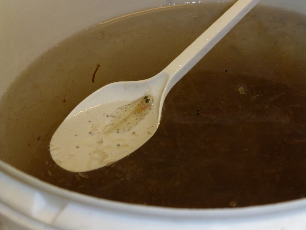
Tiny creatures, just a spoonful!
Winter light outside Tromso
![]()
Norway’s Polar Satellite Centre
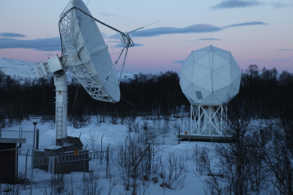
KSat ground station
Polar orbit satellites monitor what’s happening at the ends of the planet – and, of course, the regions in between. Ice conditions, land movement, shipping, pollution – but how does that information actually make its way to the scientists and authorities who evaluate it and use it as a basis for all kinds of decisions?
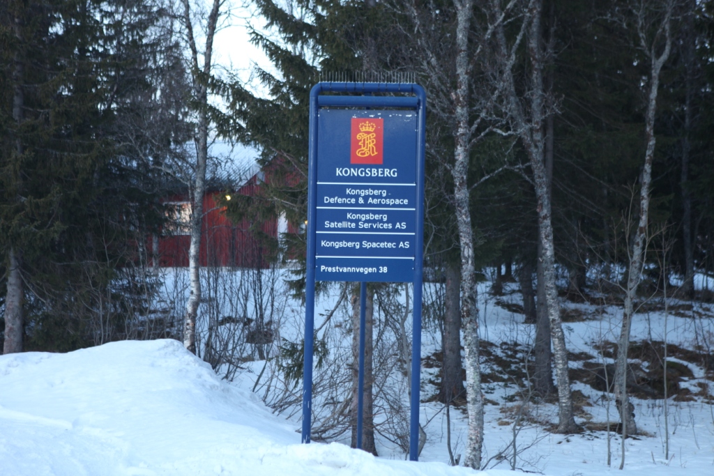
During my recent visit to Arctic Norway, I had the chance to visit a facility that plays a key role in collecting and disseminating satellite data on the polar regions. On the outskirts of Tromso, Norway’s “Gateway to the Arctic”, there is a satellite ground station, run by KSat, or Kongsberg Satellite Services AS. It is a Norwegian commercial company which provides ground station and earth observation services for polar orbiting satellites. With three interconnected polar ground stations: Tromsø at 69°N, Svalbard (SvalSat) at 78°N and Antarctic TrollSat Station at 72°S, combined with a mid-latitude network of stations in South Africa, Dubai, Singapore and Mauritius, KSAT operates over 70 antennae positioned for access to polar and geostationary orbits.
The Tromso station has contact to 85 satellites every day, and every month the station monitors some 15,000 passes of these satellites overhead.
 High demand for high-tech service
When it comes to which businesses stand to gain from climate change, the providers of satellite data have to rank high on the list. There is a huge demand for data from space, and KSat, it seems, is the biggest company worldwide carrying out this kind of activity.
Satellite enthusiast Pedersen
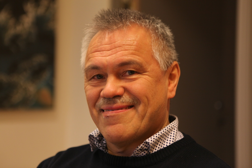
While I was in town for the Arctic Frontiers conference, two colleagues and I were shown the facility on a beautiful wintry Saturday morning by Jan Petter Pedersen, the Vice President of the company, who is responsible for developing products to expand the business. He studied physics in Tromso and got into satellites during that time, he told us, going on to a PHD in remote sensing. Pedersen has been at KSat for 20 years and says the technology has come a long way in that time. These days, it’s all about remote control via pcs.
We tend to take satellite data for granted. But if you think about it, somebody has to pick up the masses of data from all those satellites circling over the poles and pass the appropriate images to those who need them. Energy, environment, security – these are key areas which make use of the data. In the Tromso station, that data is provided to those who need it more or less in real-time. The company says it can get the data down and sent on to its destination anywhere in the world within 20 minutes. So if you want to detect an oil spill in – say – the Gulf of Mexico? – The chances are, you will get information from this Arctic town.
Some companies own and operate their own satellites, and distribute the data. KSat doesn’t own any satellites, but has agreements to use data. They can access radio data from almost all satellites in operation today.
The USA and Canada are the biggest market for the company’s services, says Pedersen. Then comes Europe, followed by Asia.
The world’s largest polar ground station is the one on the Arctic island of Svalbard. I wasn’t able to visit it during my winter trip – put it must be pretty impressive, with more than 30 antennae.
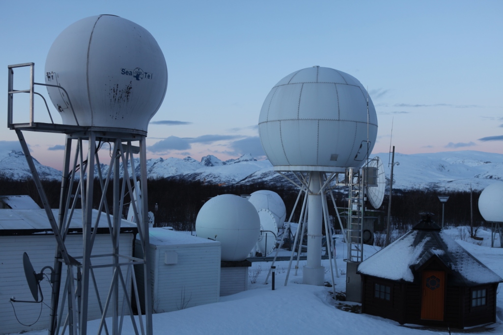
An impressive view of the Tromso station.
Satellite monitoring as deterrent to polluters?
When it comes to oil spill detection or monitoring, satellite images play a key role.
Optical sensors have limitations in bad weather, so radar satellite data are of key importance, Pedersen explains. Oil spill detection is the most important of KSat’s earth observation activities. EMSO (European marine Safety Agency) in Lisbon is responsible for European oil spill detection. They get satellite data from 4 providers of satellite data, of which KSat is the biggest. It covers 60% of the waters from the Barents Sea to the Bay of Biscay and the Baltic.
In 2008 there were 10.77 possible reported spills per million km2. In 2011, this was down to 5.08, Pedersen told us. I asked why they talk of “possible”. It seems it is not always possible to be 100 percent sure what the satellite detects is an oil spill. The reliability is somewhere over 60 percent. Pedersen believes the satellite service plays a role in decreasing the figure. As it becomes increasingly well known that satellites are observing and collecting the data, there is a higher awareness that oil spills are being detected. Presumably this is a deterrent to deliberate discharges of oil as well as a key source of information on accidents.
From pirates to icebergs
Another key use for satellite data is in monitoring ship traffic, including detecting, tracking and identifying vessels. This means the authorities can spot illegal activities and inform the coast guards. This helps in finding pirates, for instance.
Tracking icebergs and monitoring ice development have also been aided by the growing availability of satellite data. The NSIDC is one of KSat’s most important customers. They need the data to map the extent and condition of the ice.
Satellite data shows ice changes.
Ships frozen into the ice for research purposes such as the Lance, use satellite images via Tromso. Many other ships use them to chart a course when operating in ice.
Monitoring fishing activities, offshore oil exploration, tracking land movement – all these activities rely on satellite information today.
Pedersen told us the Norwegian capital Oslo is sinking at a rate of 2 cm a year. He also mentioned a landslide risk area outside of Tromso, where a mountain is sliding into the ocean. Ultimately, it will go into the fjord and create a tsunami effect, says Pedersen. That would endanger the settlement. It is moving at 15mm per year. The satellites are keeping an electronic eye on it.
Norway, incidentally, is the country with the highest use of data per person. Most of it is maritime. So it seems fitting that the country should be the location of some of the world’s most important ground stations. There is more to the picturesque Arctic harbour town of Tromso than meets the eye – I can tell you that even without satellite data!
![]()
Sharing Arctic ocean data
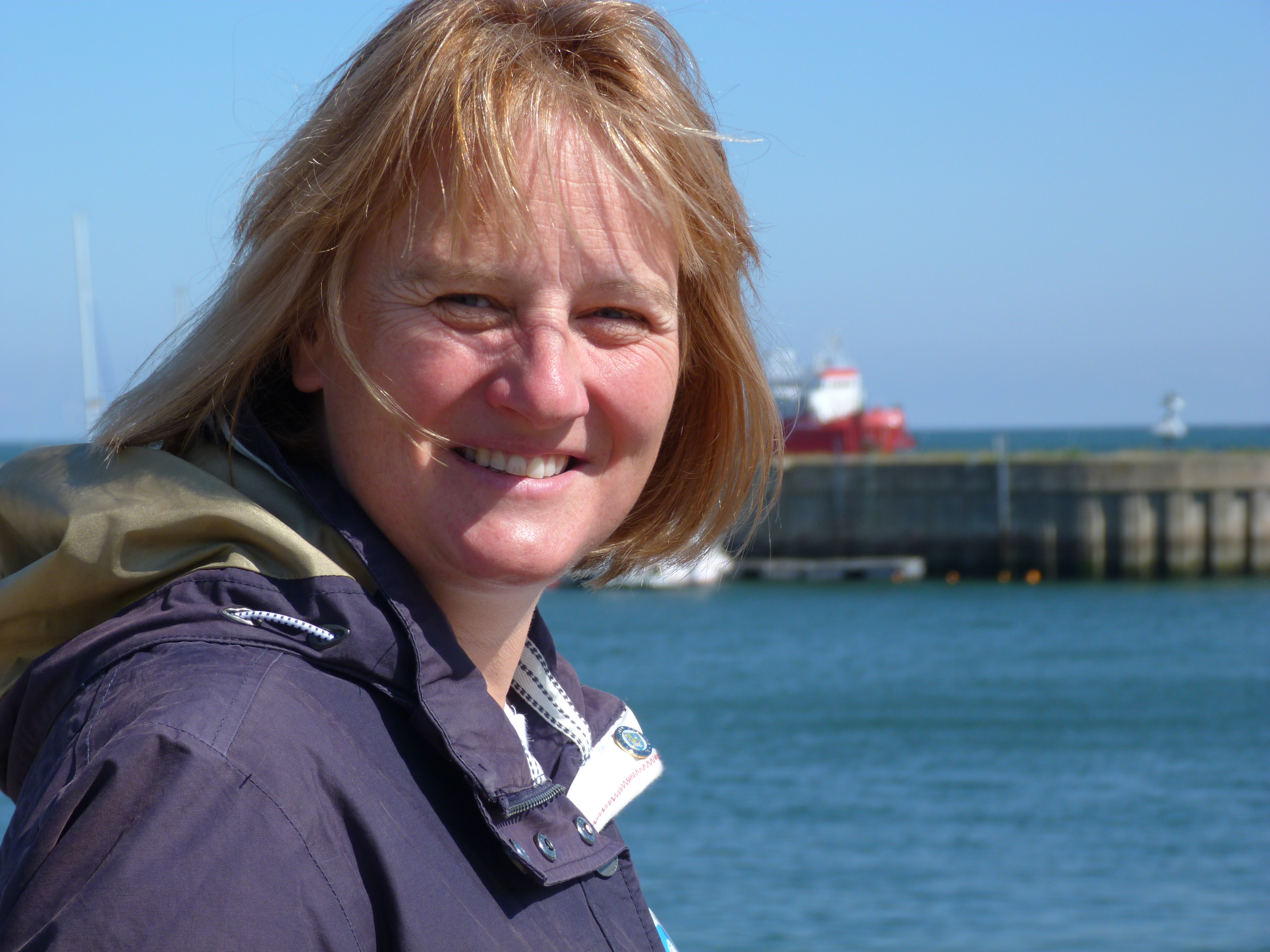
Karen Wiltshire on Helgoland (pic: I.Quaile)
This week I had an interesting conversation with Professor Karen Wiltshire, who is deputy director of Germany’s Alfred Wegener Institute for Polar and Marine Research. Last time I talked to Karen was on the German North Sea Island of Helgoland, where she is also head of AWI’s Biological Institute. “Jellyfish and chips” is the theme of the article I wrote then about the institute’s research into the impacts of climate change on the North Sea. Tasty?
This time, I was interviewing her on a wider issue, which also has direct relevance to the Arctic. She has taken over the chair of the “Partnership for Observation of the Global Oceans”, or POGO for short, for the next two years. The Directors of the group just had their annual meeting in Tenerife, on the Canary Islands. POGO, Karen told me, is one of the oldest international organizations set up to link partners interested in observing the world’s oceans. It includes all the world’s key marine institutes, including AWI, Woods Hole, Scripps and institutes from China, Korea and Russia.
The directors meet once a year to discuss issues which can be tackled in a coordinated manner. This includes things like research vessels and monitoring marine protected areas.
Exchanging Arctic Data
But one issue which could bring a lot of benefits in particular to scientists working on the Arctic, is the decision taken at the Tenerife meeting to set up a new platform to link up all the long-term ocean data sets in the world. At the moment, Professor Wiltshire says scientists often don’t know of the existence of a lot of data:
“Some of it is very high quality. For example in northern Russia, in the Arctic Ocean, there’s a lot of data that’s not so easily accessible and available. But if our Russian partners just put a flag on the map saying we have this data, and you can come to us if you need it, it would already help us scientists a lot.
“It’s kind of like making a giant inventory of what’s out there, and of what has been measured for the last hundred years. The next step would be to link important oceans with one another, the Arctic and the Atlantic, and look how they have changed relative to one another, and set up hydrographic models linking these oceans. Those models already exist, but with a better data base we might be able to check the rigor of these models, also relative to the melting ice caps. So the first step is to inventorize what’s out there, and then link data sets, variables and ocean areas.”
Stig Falk-Petersen in the hangar at Longyearbjen airport. ((I.Quaile 2015)
Russian data is key
This brings me back to conversations I had on my recent Arctic expedition on the RV Helmer Hanssen. Stig Falk-Petersen, the cruise leader, from Norway’s Arctic University of Tromso, stressed to me just how much research on the Arctic has actually been conducted by Russian scientists. In the past, this was rarely translated, so not available to the majority of the international research community. Things have changed since the end of the Soviet Union, Stig told me, and it became easier for western scientists to work with their Russian colleagues.
“And what we discovered then, was that the Russians know all about our famous polar explorers Nansen and Amundsen, but we new nothing about the Russians. Yet the Russians have a fantastic record of science in the Arctic. Since 1937 they have had these drifting stations, they flew out from Novaya Zemlya and landed on North Pole with four engines, Antonov planes, and established an ice camp. And they drifted out the Fram Strait. They have done this nearly every year until recently. So all we know about the Arctic , the topography, situation of water masses, animal life, benthic life, is actually based on Russian expeditions. And this is still poorly known in the west.”
Modern ice drift
Stig is a great fan of a current drift venture, the Fram 2013-2014 expedition, which is more or less repeating that of the first Russian drift station.
The Norwegian scientists Yngve Kristoffersen and Audun Tholfsen are living and working on their ice drift station, including the hovercraft “Sabvabaa”. It was taken and placed on the ice by the AWI’s research vessel the Polarstern, demonstrating once more the benefits of international cooperation in science. The two men have been taking sediment cores to learn about the polar environment more than 60 million years ago. Since August 2014 they have moved northwards along the submarine Lomonosov Ridge. You can follow their progress online at Geonova. Let me just quote a little from their latest diary:
“The length of Lomonosov Ridge ( ̴1.800 km) is roughly equal to the length of Norway. We have now spent 5 months drifting over the Lomonosov Ridge and been able to get new scientific data over a section which constitutes 1/4 of the total length of the ridge. Our drift shows a pattern with periods of very slow ice drift interrupted by events of fast drift. The fast drift is forced by cells of low surface air pressure moving in to the Arctic Ocean over the Canadian Arctic Islands as lately or through the Fram Strait. As they move in, the wind direction drives the ice to the west. These events, unpredictable on a time scale of months, make it impossible to estimate with some degree of confidence where we will be when it is time for Audun to rotate off in late March/April or when we will approach the ice edge in the Fram Strait.”
The data recorded by the scientists is transferred automatically to the Nansen Centre in Bergen. Stig tells me it includes some spectacular underwater videos going right down to the sea bottom, 2000 metres. He and his colleagues are eagerly awaiting a look at the data.

Data from polar orbit satellites is received and processed at KSAT in Tromso. I was able to visit in January. (Pic. I Quaile)
These days, modern technology, from satellite monitoring to a network of buoys moored around the world’s oceans, some with remote data transmission, provide an increasing amount of new data to be shared and analysed. But to understand properly how the oceans are changing, we need data from the past to compare it with. This brings me back to my interview with Karen Wiltshire.
I asked her whether there wasn‘t a danger that research is not able to keep up with the speed of change? Here is her answer:
“There’s very much the danger of that. One of the most important things is having consistent long-term observation. We need to link up old observations, be it whether somebody stood at the end of a dock and measured salinity for a time, in the late 1800s or so, through to now, where we have modern ways of measuring. These things need to be linked and compared to each other to find out whether what you are looking at is related to a real trend or shift, or is just an anomaly in the system. One has to be very mathematically oriented and creative in doing so. Very often, for example in the Wadden Sea, (off the coasts of Germany, Denmark and the Netherlands), we even use historical anecdotes written down in the annals of churches, for example, to look at how the weather was at a certain time, whether we had an ice winter or not. The more information we have from the past, the better it is. Then we’re in a better position to interpret modern-day data, which might be of very short duration in comparison to the long sets of data out there.”
So the new project to link the world’s oceanic data could be a very important step forward. Here’s to success for the latest POGO venture!
You can listen to the interview with Karen Wiltshire on this week’s Living Planet programme, or by itself here.
![]()


Feedback